Clearing Skies By Tonight
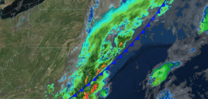
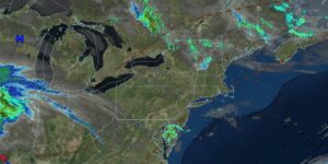
UPDATED 06/23/26 4:17 PM Cool and damp conditions this evening will give way to sunshine by tomorrow morning. An unsettled weather pattern continues into the

UPDATED 06/23/26 4:17 PM Cool and damp conditions this evening will give way to sunshine by tomorrow morning. An unsettled weather pattern continues into the
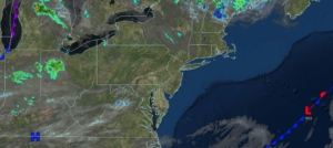
UPDATED 06/23/26 10:07 AM Cool and damp conditions today will give way to sunshine by tomorrow morning. An unsettled weather pattern continues into the weekend
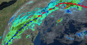
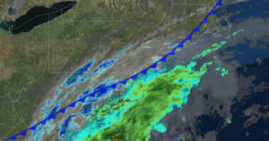
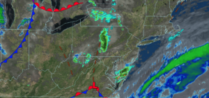
UPDATED 06/22/26 5:33 PM Waves of showers and thunderstorms will continue through tomorrow morning. A few isolated thunderstorms may reach severe levels with intense downpours,
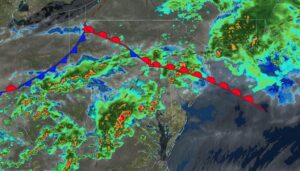
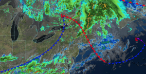
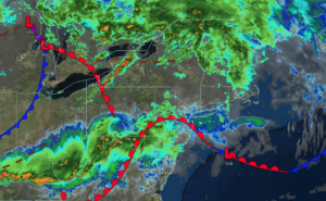
UPDATED 06/22/26 10:23 AM A warm front this morning and a cold front tonight will produce waves of showers and thunderstorms. A few isolated thunderstorms
UPDATED 06/21/26 10:00 AM Tranquil conditions will be in place for Father’s Day. Widespread showers and thunderstorms return tomorrow with some significant impacts on the
UPDATED 06/20/26 10:00 AM Tranquil conditions will be in place through the weekend. Widespread showers and thunderstorms return on Monday with some significant impacts on
UPDATED 06/19/26 9:42 AM Tranquil conditions will be in place through the weekend. Widespread showers and thunderstorms return on Monday with some significant impacts on
UPDATED 06/18/26 3:03 PM Powerful thunderstorms in New England will limit thunderstorms in the Northern Mid Atlantic, however an active weather pattern is expected through
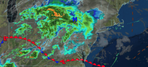
UPDATED 06/18/26 10:09 AM An active weather pattern returns with waves of showers and thunderstorms today and more threats next week! TODAY A warm front
UPDATED 06/17/26 9:49 AM A warm front will produce increasing clouds and isolated showers today. A cold front will bring showers and thunderstorms to the