Heavy Rain And Thunderstorms Return Late Tonight
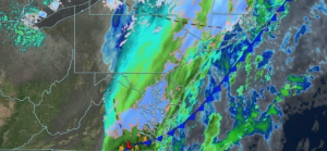
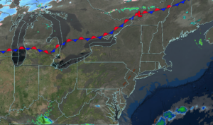
UPDATED 03/15/26 4:49 PM A warm front will bring waves of heavy rainfall late tonight through tomorrow morning. A cold front will then produce waves

UPDATED 03/15/26 4:49 PM A warm front will bring waves of heavy rainfall late tonight through tomorrow morning. A cold front will then produce waves
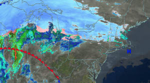
UPDATED 03/15/26 10:12 AM A warm front will bring waves of heavy rainfall late tonight through tomorrow morning. A cold front will then produce waves
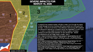
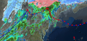
UPDATED 03/14/26 9:30 AM A series of troughs and frontal boundaries will keep this weekend chilly and unsettled. A significant severe thunderstorm threat is brewing
UPDATED 03/13/26 9:40 AM Many consider Friday the 13th unlucky, but this time, many will note how chilly the weather turned after record-high temperatures over
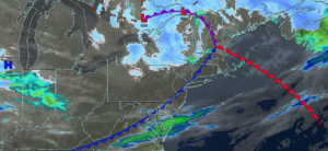
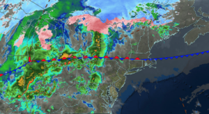
UPDATED 03/12/26 3:27 PM Rain mixing over to snow will mark the end of the warm weather pattern with some slick roadways tonight. A volatile
UPDATED 03/12/26 9:57 AM A cold front will produce waves of rainfall, gradually changing over to snow as temperatures fall throughout the day. A volatile
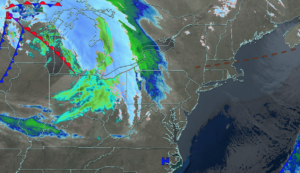
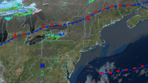
UPDATED 03/11/26 4:56 PM Showers and thunderstorms will invade the region this evening as the pattern shifts back to a chillier regime. THIS EVENING A
UPDATED 03/11/26 9:55 AM Showers and thunderstorms will invade the region this afternoon and evening as the pattern shifts back to a chillier regime. TODAY
UPDATED 03/10/26 4:43 PM Excellent weather will continue through tonight. Showers and thunderstorms return tomorrow, with some potential for severe storms. Chillier weather conditions are
UPDATED 03/10/26 10:08 AM Excellent weather will continue through this evening. Showers and thunderstorms return tomorrow with some potential for thunderstorms reaching severe levels. Chillier
