
A Muggy, Uncomfortable Evening
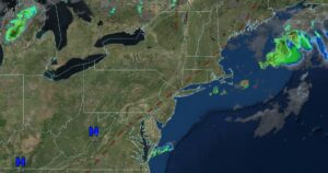
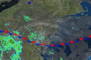
UPDATED 07/02/26 3:14 PM Hazy, hot, and humid conditions, along with a dangerous heat index and isolated tropical thunderstorms, will be a threat today through

UPDATED 07/02/26 3:14 PM Hazy, hot, and humid conditions, along with a dangerous heat index and isolated tropical thunderstorms, will be a threat today through
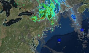
UPDATED 07/02/26 9:02 AM Hazy, hot, and humid conditions, along with a dangerous heat index and isolated tropical thunderstorms, will be a threat today through

UPDATED 07/01/26 5:25 PM Muggy conditions with some areas of fog will develop tonight. Hazy, hot, and humid conditions, along with a dangerous heat index

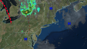
UPDATED 07/01/26 8:48 AM Hazy, hot, and humid conditions with a dangerous heat index and isolated tropical thunderstorms will be a threat today through the
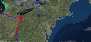
UPDATED 06/30/26 4:45 PM Scattered clouds and some patchy fog will develop tonight as humidity increases. Hazy, hot, and humid conditions with a dangerous heat
UPDATED 06/30/26 8:55 AM Tranquil but hotter conditions today will give way to hazy, hot, and humid conditions with a dangerous heat index and isolated
UPDATED 06/29/26 6:25 PM Tranquil conditions tonight will give way to hazy, hot, and humid conditions with a dangerous heat index and isolated tropical thunderstorms

UPDATED 06/29/26 9:12 AM Sunny and seasonable conditions today will give way to hazy, hot, and humid conditions with a dangerous heat index and isolated
UPDATED 06/28/26 10:15 AM Clearing skies will gradually take hold as high pressure builds into the region. Hazy, hot, and humid conditions return by next

UPDATED 06/27/26 9:55 AM A stationary front will produce unsettled conditions and waves of showers today. Hazy, hot, and humid conditions return by next week