UPDATED 11/12/26 3:00 PM
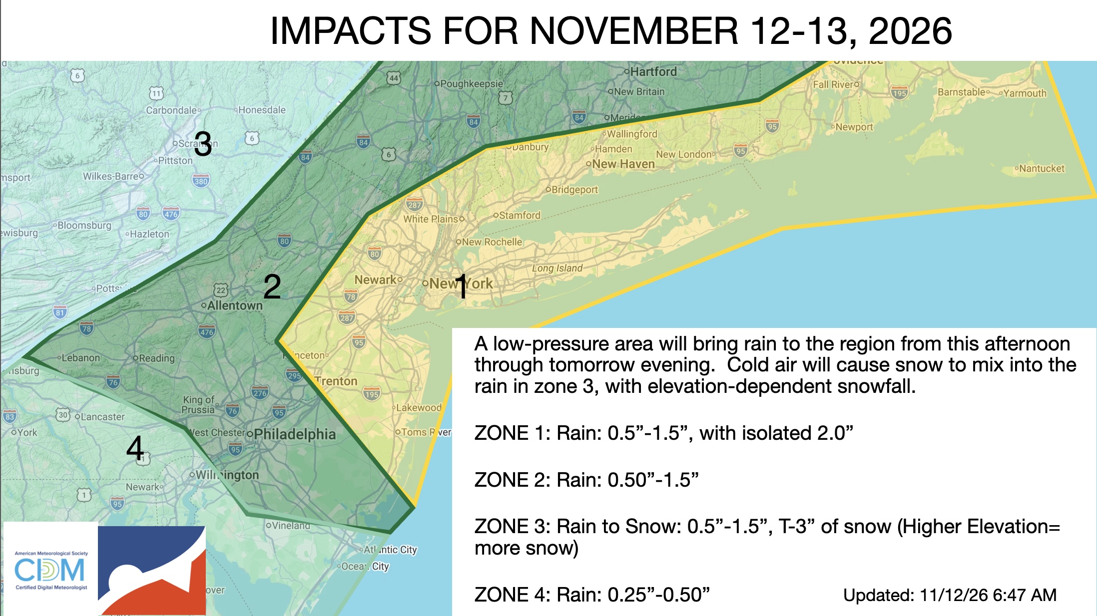
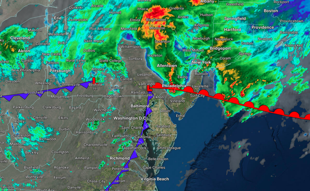
A low-pressure area will produce strong thunderstorms, heavy rain, and higher-elevation snowfall today through tomorrow. Chilly conditions return by the weekend.
TONIGHT
A low-pressure area will intensify over the coastal waters, bringing periods of rain. Snow will begin to mix with the rain over the higher elevations towards morning, with some minor snow accumulation on cold surfaces. Coastal flooding will be a threat. Winds will back to the northeast at 5 to 15 mph with gusts up to 25 mph. Low temperatures will range from the lower to mid-30s over the interior and upper 30s to lower 40s along the coast.
TOMORROW
A low-pressure system will organize over the coastal waters, bringing periods of rain for most of the region and a wintry mix of snow and rain at elevations over 1,500 feet. Coastal flooding will be a threat. Winds will back to the northwest at 5 to 15 mph with gusts up to 30 mph. High temperatures will range from the mid to upper 30s over the interior and lower to mid-40s along the coast.
TOMORROW NIGHT
An inverted trough will drop south of the region, bringing scattered rain/snow showers. Winds will be from the northwest at 5 to 15 mph. Low temperatures will range from the upper 20s to lower 30s over the interior and mid to upper 30s along the coast.
SATURDAY
An inverted trough will drop south of the region, bringing scattered rain/snow showers in the morning, followed by clearing skies. Winds will be from the northwest at 5 to 15 mph. High temperatures will range from the upper 30s to lower 40s over the interior and lower to mid-40s along the coast.
SUNDAY
High pressure will produce scattered clouds with a few flurries. Winds will be from the northwest at 5 to 15 mph. Low temperatures will range from the upper 20s to lower 30s over the interior, mid to upper 30s in the suburbs, and upper 30s to lower 40s in urban areas. High temperatures will range from the lower to mid-40s over the interior and the upper 40s to lower 50s along the coast.
MONDAY
High pressure will produce scattered clouds. Low temperatures will range from the upper 20s to lower 30s over the interior, mid to upper 30s in the suburbs, and upper 30s to lower 40s in urban areas. High temperatures will range from the lower to mid-40s over the interior and the upper 40s to lower 50s along the coast.
TUESDAY
High pressure will produce scattered clouds. Low temperatures will range from the upper 20s to lower 30s over the interior, mid to upper 30s in the suburbs, and upper 30s to lower 40s in urban areas. High temperatures will range from the lower to mid-50s over the interior and the mid to upper 50s along the coast.
WEDNESDAY
High pressure will produce scattered clouds. Low temperatures will range from the upper 20s to lower 30s over the interior, mid to upper 30s in the suburbs, and upper 30s to lower 40s in urban areas. High temperatures will range from the lower to mid-50s over the interior and the mid to upper 50s along the coast.
THURSDAY
High pressure will produce scattered clouds. Low temperatures will range from the upper 20s to lower 30s over the interior, mid to upper 30s in the suburbs, and upper 30s to lower 40s in urban areas. High temperatures will range from the lower to mid-50s over the interior and the mid to upper 50s along the coast.