
UPDATED 11/06/26 10:13 AM
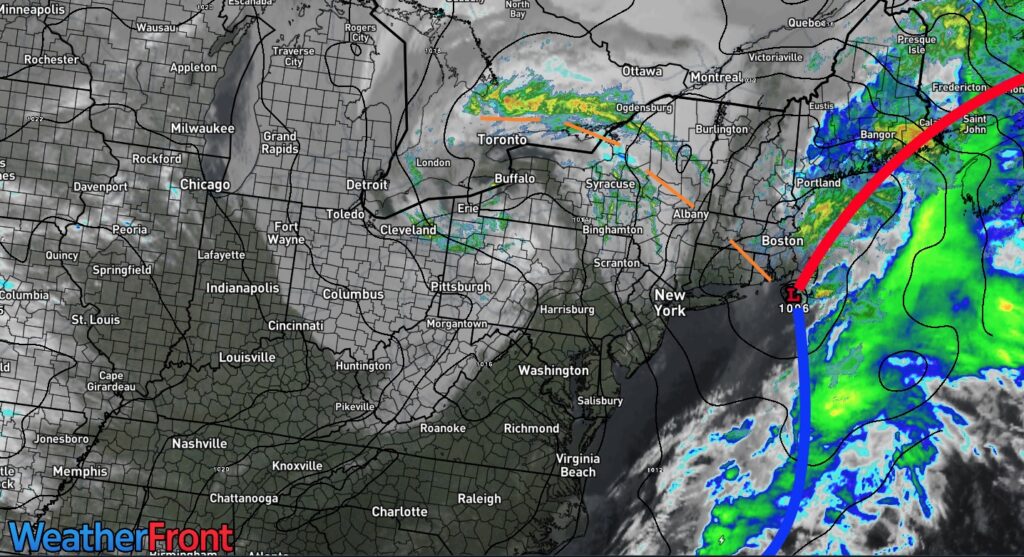
A series of troughs will keep the threat of a few isolated showers in the forecast. A coastal storm will threaten by the end of next week.
TODAY
A low-pressure area and a trough will produce scattered clouds and isolated showers. Winds will veer to the west at 5 to 15 mph. High temperatures will range from the lower to mid-50s over the interior, mid to upper 50s on Long Island, and upper 50s to lower 60s along the I-95 corridor.
TONIGHT
A trough will produce scattered clouds and isolated showers. Winds will be from the west at 5 to 15 mph. Low temperatures will range from the mid-to-upper 40s.
TOMORROW
A trough will produce scattered clouds. Winds will be from the west at 5 to 15 mph. High temperatures will range from the lower to mid-50s over the interior and upper 50s to lower 60s along the coast.
TOMORROW NIGHT
A trough will produce variable clouds and isolated showers. Winds will be from the northwest at 10 to 20 mph. Low temperatures will range from the lower to mid-40s over the interior and mid to upper 40s along the coast.
MONDAY
A trough will produce variable clouds and isolated showers. Winds will be from the northwest at 10 to 20 mph. High temperatures will range from the lower to mid-50s over the interior and mid to upper 50s along the coast.
TUESDAY
A trough will produce scattered clouds. Winds will be from the west at 5 to 15 mph. Low temperatures will range from the lower to mid-30s over the interior, the upper 30s to lower 40s in the suburbs, and the lower to mid-40s along the coast and in urban areas. High temperatures will range from the mid-to-upper 50s over the interior and Long Island and the lower to mid-60s along the I-95 corridor.
WEDNESDAY
A weak cold front will produce scattered clouds with a few isolated showers. Low temperatures will range from the upper 30s to the lower 40s over the interior and the mid-to-upper 40s along the coast. High temperatures will range from the lower to mid-50s over the interior and upper 50s to lower 60s along the coast.
THURSDAY
A low-pressure area will approach the region, bringing increasing clouds and scattered showers. Low temperatures will range from the lower to mid-30s over the interior, the upper 30s to lower 40s in the suburbs, and the lower to mid-40s along the coast and in urban areas. High temperatures will range from the lower to mid-40s over the interior and upper 40s to lower 50s along the coast.
FRIDAY
A low-pressure area will develop over the coastal waters, bringing periods of rain and higher-elevation snowfall. Low temperatures will range from the lower to mid-30s at higher elevations, the mid to upper 30s over the interior, and the lower to mid-40s along the coast. High temperatures will range from the upper 30s to the lower 40s over the interior and the mid- to upper-40s along the coast.
SATURDAY
A low-pressure area will exit the region, bringing variable clouds and isolated rain/snow showers. Low temperatures will range from the lower to mid-30s over the interior and mid to upper 30s along the coast. High temperatures will range from the mid-to-upper 30s over the interior and the lower- to mid-40s along the coast.


