
UPDATED 10/20/26 8:19 AM
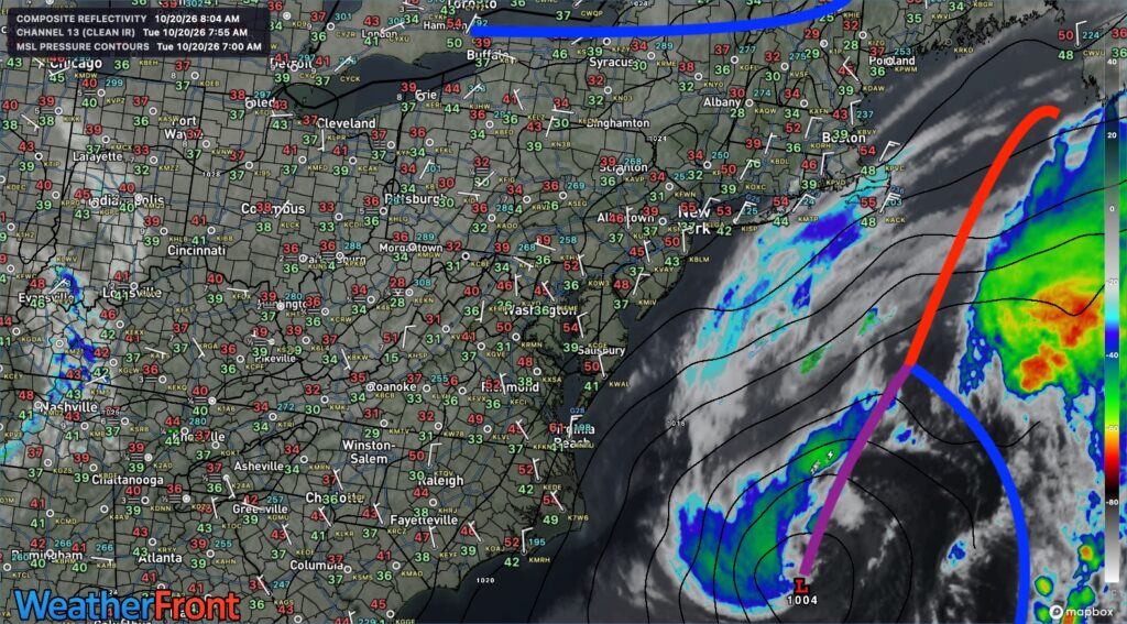
High pressure will keep the region dry and tranquil through the week and into the weekend, but an ocean storm will increase the potential for coastal flooding through Thursday morning.
TODAY
High pressure will produce clear skies. Northeast winds will be 5 to 15 mph. High temperatures will range from the mid-60s.
TONIGHT
High pressure will produce clear skies. Northeast winds will be 5 to 15 mph. Low temperatures will range from the mid-to-upper 30s over the interior, the lower-to-mid 40s in the suburbs, and the mid-to-upper 40s in urban areas.
TOMORROW
High pressure will produce clear skies. Northeast winds will be 5 to 15 mph. High temperatures will range from the mid-to-upper 50s over the interior and Long Island to the upper 50s to lower 60s along the I-95 corridor.
TOMORROW NIGHT
High pressure will produce clear skies. Winds will back to the north at 5 to 10 mph. Low temperatures will range from the mid- to upper-30s over the interior and the low- to mid-40s in the suburbs, and mid to upper 40s in urban areas.
THURSDAY
High pressure will produce clear skies. Winds will back to the northwest at 5 to 15 mph. High temperatures will range from the mid- to upper-50s over the interior and the lower- to mid-60s along the coast.
FRIDAY
High pressure will produce scattered clouds. Winds will be from the northwest at 5 to 15 mph. Low temperatures will range from the lower to mid-30s over the interior, upper 30s to lower 40s in the suburbs, and lower to mid-40s in urban areas. High temperatures will range from the upper 40s to lower 50s over the interior and lower to mid-50s along the coast.
SATURDAY
High pressure will produce scattered clouds. Low temperatures will range from the upper 20s to lower 30s over the interior, mid to upper 30s in the suburbs, and upper 30s to lower 40s in urban areas. High temperatures will range from the mid-to-upper 50s.
SUNDAY
High pressure will produce scattered clouds. Low temperatures will range from the mid-to-upper 30s over the interior, the upper 30s to lower 40s in the suburbs, and the lower to mid-40s in urban areas. High temperatures will range from the lower to mid-60s.
MONDAY
High pressure will produce scattered clouds. Low temperatures will range from the mid-to-upper 30s over the interior, the upper 30s to lower 40s in the suburbs, and the lower to mid-40s in urban areas. High temperatures will range from the mid- to upper-60s.
TUESDAY
High pressure will exit with scattered clouds. Low temperatures will range from the lower to mid-40s over the interior and upper 40s to lower 50s along the coast. High temperatures will range from the lower to mid-50s over higher elevations, the mid to upper 50s over the interior, and the lower to mid-60s along the coast.


