
UPDATED 10/18/26 10:02 AM
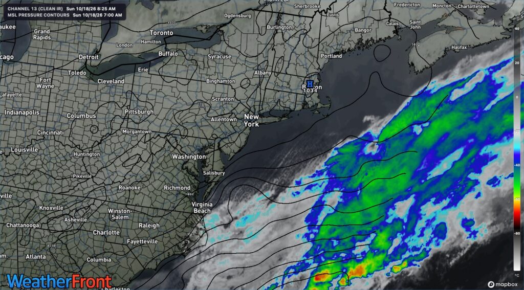
High pressure will provide sunny but chilly weather today. A developing coastal low-pressure system south of the region and high pressure to the north will produce persistent northeasterly winds, scattered clouds, and coastal flooding through the upcoming week.
TODAY
High pressure will produce scattered clouds. Winds will veer to the northeast at 1 to 10 mph. High temperatures will range from the lower to mid-50s.
TONIGHT
A low-pressure area will linger south of the region, bringing scattered clouds. Coastal flooding will be a threat. Northeast winds will be 5 to 15 mph. Low temperatures will range from the lower to mid-30s over the interior, upper 30s to lower 40s in the suburbs, and lower to mid-40s in urban areas.
TOMORROW
A low-pressure area will linger south of the region, bringing scattered clouds. Coastal flooding will be a threat. Northeast winds will be 5 to 15 mph. High temperatures will range from the mid-to-upper 50s along the coast and the upper 50s to lower 60s over the interior.
TOMORROW NIGHT
A low-pressure area will linger south of the region, bringing scattered clouds. Coastal flooding will be a threat. Northeast winds will be 5 to 15 mph. Low temperatures will range from the upper 30s to lower 40s over the interior, mid to upper 40s in the suburbs, and lower to mid-50s in urban areas and along the coast.
TUESDAY
A low-pressure area will linger south of the region, bringing scattered clouds. Coastal flooding will be a threat. Northeast winds will be 5 to 15 mph. High temperatures will range from the lower to mid-60s.
WEDNESDAY
A low-pressure area will linger south of the region, bringing scattered clouds. Coastal flooding will be a threat. Winds will be from the northeast at 5 to 15 mph. Low temperatures will range from the upper 30s to lower 40s over the interior, mid to upper 40s in the suburbs, and lower to mid-50s in urban areas and along the coast. High temperatures will range from the lower to mid-60s.
THURSDAY
A low-pressure area will linger south of the region, bringing scattered clouds. Coastal flooding will be a threat. Winds will be from the northeast at 5 to 15 mph. Low temperatures will range from the mid-to-upper 40s over the interior and the upper 40s to lower 50s along the coast. High temperatures will range from the mid- to upper-50s.
FRIDAY
High pressure will build into the region with clearing skies. Coastal flooding will be a threat. Low temperatures will range from the mid- to upper-30s over the interior, lower to mid-40s in the suburbs, and upper 40s to mid-50s along the coast and urban areas. High temperatures will range from the lower to mid-60s.
SATURDAY
High pressure will produce scattered clouds. Coastal flooding will be a threat. Low temperatures will range from the lower to mid-30s over the interior, mid to upper 30s in the suburbs, and upper 30s to lower 40s along the coast and urban areas. High temperatures will range from the lower to mid-50s.
SUNDAY
High pressure will produce scattered clouds. Coastal flooding will be a threat. Low temperatures will range from the lower to mid-30s over the interior and mid to upper 30s along the coast. High temperatures will range from the upper 50s to the lower 60s.


