
UPDATED 10/02/26 9:02 AM
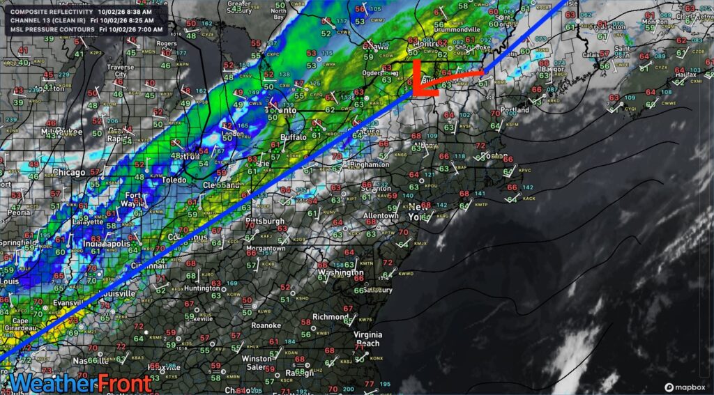
Summer-like weather today will give way to showers tonight as a cold front moves through. Showers will be possible Sunday, followed by chilly conditions next week.
TODAY
High pressure will exit the region with increasing clouds. Winds will be from the southwest at 5 to 10 mph. High temperatures will range from the mid to upper 70s over the interior and Long Island and lower to mid-80s along the I-95 corridor.
TONIGHT
A cold front will produce scattered showers. Winds will veer to the northwest at 5 to 10 mph. Low temperatures will range from the mid-to-upper 40s over the interior, lower to mid-50s in the suburbs, and mid-to-upper 50s in urban areas.
TOMORROW
A cold front will exit the region with scattered showers in the early morning, followed by scattered clouds. Winds will veer to the north at 5 to 10 mph. High temperatures will range from the mid-to-upper 60s over the interior and the upper 60s to lower 70s along the coast.
TOMORROW NIGHT
High pressure will produce scattered clouds. Winds will veer to the northeast at 5 to 10 mph. Low temperatures will range from the mid to upper 40s over the interior, lower to mid-50s in the suburbs, and mid to upper 50s in urban areas and along the coast.
SUNDAY
A stationary front and wave of low pressure over the coastal waters will produce cloudy skies and scattered showers. Southeastern New Jersey should expect widespread showers. Winds will be from the northeast at 5 to 10 mph. High temperatures will range from the lower to mid-60s over the interior and mid to upper 60s along the coast.
MONDAY
High pressure will build into the region with clearing skies. Low temperatures will range from the lower to mid-50s. High temperatures will range from the lower to mid-60s over the interior and upper 60s to lower 70s along the coast.
TUESDAY
High pressure will produce clear skies. Frost will be a threat in the morning hours. Low temperatures will range from the upper 30s to the lower 40s over the interior and the mid-to-upper 40s along the coast. High temperatures will range from the mid-to-upper 50s over the interior and the lower to mid-60s along the coast.
WEDNESDAY
High pressure will produce clear skies. Frost will be a threat in the morning hours. Low temperatures will range from the upper 30s to the lower 40s over the interior and the mid-to-upper 40s along the coast. High temperatures will range from the lower to mid-60s.
THURSDAY
High pressure will exit the region, bringing scattered clouds and an onshore flow. Low temperatures will range from the mid to upper 40s over the interior, the upper 40s to lower 50s in the suburbs, and the lower to mid-50s in urban areas and along the immediate coast. High temperatures will range from the mid-to-upper 60s on Long Island, the lower-to-mid 70s along the I-95 corridor, and the upper 60s to lower 70s over the interior.
FRIDAY
High pressure will exit the region, bringing scattered clouds and an onshore flow. Low temperatures will range from the mid to upper 40s over the interior, the upper 40s to lower 50s in the suburbs, and the lower to mid-50s in urban areas and along the immediate coast. High temperatures will range from the mid-to-upper 60s on Long Island, the lower-to-mid 70s along the I-95 corridor, and the upper 60s to lower 70s over the interior.

