
UPDATED 09/28/26 8:48 AM
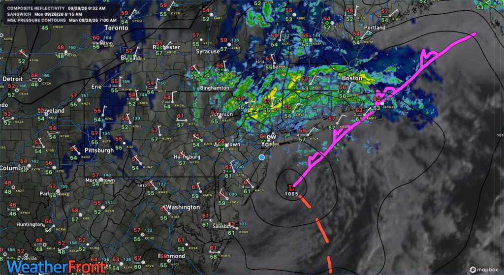
A powerful nor’easter will move out of the region today, with lingering showers. Drier, warmer weather develops through the rest of the week.
TODAY
The coastal low-pressure system will exit the region with variable clouds and periods of showers. Winds will back to the west at 5 to 15 mph. High temperatures will range from the lower to mid-60s over the interior and Long Island and mid to upper 60s along the I-95 corridor.
TONIGHT
A trough will produce scattered clouds and isolated showers. Winds will be from the northwest at 5 to 10 mph. Low temperatures will range from the mid-to-upper 50s.
TOMORROW
A trough will produce scattered clouds and isolated showers. Winds will be from the northwest at 5 to 10 mph. High temperatures will range from the mid to upper 60s over the interior and Long Island and lower to mid-70s along the I-95 corridor.
TOMORROW NIGHT
High pressure will produce scattered clouds. Winds will be from the west at 5 to 10 mph. Low temperatures will range from the upper 40s to lower 50s over the interior and mid to upper 50s along the coast.
WEDNESDAY
High pressure will produce clear skies to a few clouds. Winds will be from the west at 1 to 5 mph. High temperatures will range from the lower to mid-70s.
THURSDAY
High pressure will produce scattered clouds. Winds will be from the southwest at 5 to 10 mph. Low temperatures will range from the upper 50s to lower 60s. High temperatures will range from the lower to mid-70s on Long Island and mid to upper 70s elsewhere.
FRIDAY
A cold front will approach the region, bringing increasing clouds and showers by evening. Low temperatures will range from the lower to mid-60s. High temperatures will range from the mid to upper 70s on Long Island, lower to mid-80s along the I-95 corridor, and upper 70s to lower 80s over the interior.
SATURDAY
A stationary front with waves of low pressure will produce scattered showers. Low temperatures will range from the mid to upper 50s over the interior and lower to mid-60s along the coast. High temperatures will range from the mid- to upper-60s.
SUNDAY
A stationary front will linger over the region with periods of showers. Low temperatures will range from the mid- to upper-50s. High temperatures will range from the lower to mid-60s.
MONDAY
High pressure will produce clearing skies. Low temperatures will range from the upper 40s to lower 50s over the interior and lower to mid-50s along the coast. High temperatures will range from the upper 50s to lower 60s over the interior and lower to mid-60s along the coast.


