
UPDATED 09/23/26 8:23 AM
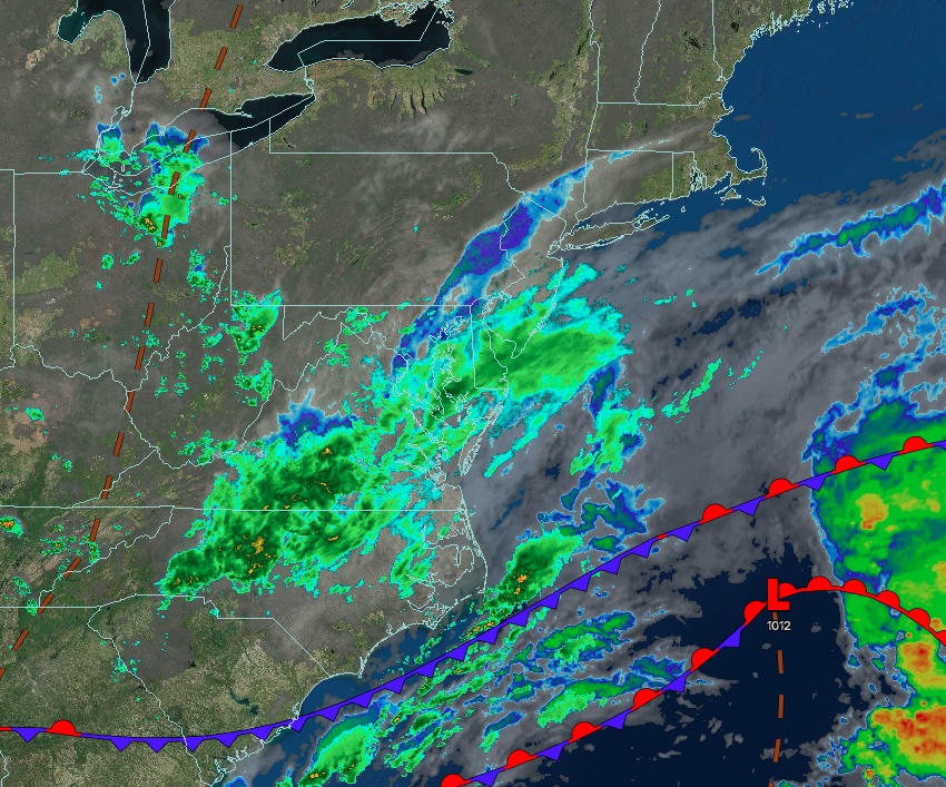
An onshore wind will continue with some low clouds, isolated showers, and coastal flooding through the week. A powerful nor’easter threatens this weekend with coastal flooding, urban flooding, power outages, poor driving conditions, and wind damage.
TODAY
A stationary boundary will produce scattered clouds and isolated showers. Winds will be from the northeast at 5 to 15 mph. High temperatures will range from the lower to mid-60s.
TONIGHT
A stationary boundary will produce variable clouds and isolated showers. Low temperatures will range from the mid-40s to the upper 40s over the interior and the lower to mid-50s along the coast.
TOMORROW
A stationary boundary will produce scattered clouds and isolated showers. Winds will be from the northeast at 5 to 15 mph. High temperatures will range from the lower to mid-60s.
TOMORROW NIGHT
A stationary boundary will produce scattered clouds and isolated showers. Winds will be from the northeast at 5 to 15 mph. Low temperatures will range from the lower to mid-40s over the interior, upper 40s to lower 50s in the suburbs, and lower to mid-50s in urban areas.
FRIDAY
A stationary boundary will produce scattered clouds and isolated showers. Winds will be from the northeast at 5 to 15 mph. High temperatures will range from the upper 60s to lower 70s.
SATURDAY
A low-pressure area will approach from the Atlantic, bringing increasing clouds and rain by evening. Winds will be from the northeast at 5 to 15 mph away from the coast and 10 to 20 mph along the coast with gusts over 30 mph. Low temperatures will range from the upper 40s to lower 50s over the interior, mid to upper 50s in the suburbs, and upper 50s to lower 60s in urban areas. High temperatures will range from the lower to mid-60s on Long Island and upper 60s to lower 70s elsewhere.
SUNDAY
A low-pressure area will produce periods of rain and windy conditions. Coastal flooding, urban flooding, wind damage, and very poor driving conditions are expected. Low temperatures will range from the mid-to-upper 50s. High temperatures will range from the lower to mid-60s.
MONDAY
A low-pressure area will produce periods of rain and windy conditions. Low temperatures will range from the mid-to-upper 50s over the interior and the low-to-mid 60s along the coast. High temperatures will range from the lower to mid-60s.
TUESDAY
A trough will produce cloudy skies and scattered showers. Low temperatures will range from the mid-to-upper 50s over the interior and the upper 50s to lower 60s along the coast. High temperatures will range from the mid-to-upper 60s on Long Island and the upper 60s to lower 70s elsewhere.
WEDNESDAY
High pressure will produce clear skies to a few clouds. Low temperatures will range from the lower to mid-50s. High temperatures will range from the upper 60s to lower 70s on Long Island and mid to upper 70s elsewhere.


