
UPDATED 08/18/26 9:04 AM
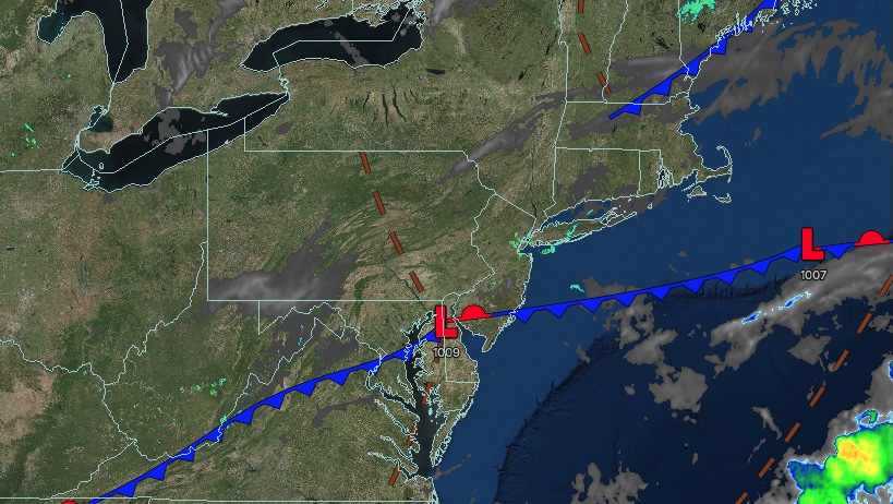
A cold front will keep low clouds and isolated showers a continuing threat today, but sunshine returns tomorrow. More rainfall is expected on the coast by Thursday.
TODAY
A cold front and waves of low pressure will produce variable clouds and isolated showers. Winds will be from the northwest at 1 to 5 mph. High temperatures will range from the upper 70s to lower 80s over the interior and Long Island, and to the mid-80s along the I-95 corridor.
TONIGHT
High pressure will produce scattered clouds. Winds will be from the west at 1 to 5 mph. Low temperatures will range from the upper 50s to lower 60s over the interior, mid-to-upper 60s in the suburbs, and upper 60s to lower 70s in urban areas.
TOMORROW
High pressure will produce scattered clouds. Winds will be from the west at 5 to 10 mph. High temperatures will range from the lower to mid-80s.
TOMORROW NIGHT
A cold front will approach the region with increasing clouds and showers developing after midnight. Winds will be from the southwest at 1 to 5 mph. Low temperatures will range from the lower to mid-60s over the interior and upper 60s to lower 70s along the coast.
THURSDAY
A cold front will produce periods of rain along the coast and scattered showers over the interior. Winds will be from the southwest at 1 to 5 mph. High temperatures will range from the upper 70s to lower 80s.
FRIDAY
High pressure will produce scattered clouds. Winds will veer to the northeast at 1 to 5 mph. Low temperatures will range from the mid to upper 50s over the interior and lower to mid-60s along the coast. High temperatures will range from the upper 70s to lower 80s over the interior and lower to mid-80s along the coast.
SATURDAY
A low-pressure area will produce periods of rain along the coast and scattered showers over the interior. Low temperatures will range from the upper 50s to lower 60s over the interior and mid-60s along the coast. High temperatures will range from the mid-to-upper 70s along the coast and the upper 70s to lower 80s over the interior.
SUNDAY
A cold front will produce scattered showers. Low temperatures will range from the mid-to-upper 60s. High temperatures will range from the mid-to-upper 70s over the interior and upper 70s to lower 80s along the coast.
MONDAY
A trough will produce variable clouds and scattered showers. Low temperatures will range from the mid-to-upper 50s over the interior and the lower to mid-60s along the coast. High temperatures will range from the mid-to-upper 70s over the interior, the lower to mid-80s along the I-95 corridor, and the upper 70s to lower 80s on Long Island.
TUESDAY
A trough will produce variable clouds and scattered showers. Low temperatures will range from the mid-to-upper 50s over the interior and the lower to mid-60s along the coast. High temperatures will range from the mid-to-upper 70s over the interior, lower to mid-80s along the I-95 corridor, and upper 70s to lower 80s on Long Island.


