


UPDATED 07/09/26 3:52 PM
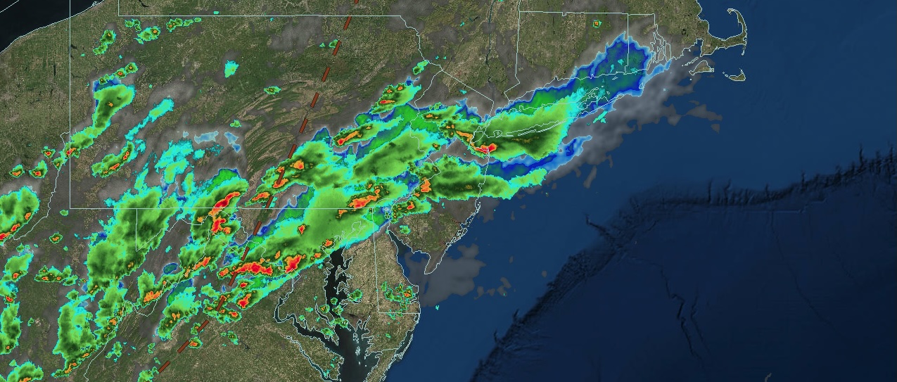
An approaching warm front will bring showers and thunderstorms that could lead to flash flooding in southeastern Pennsylvania, central New Jersey, and southern New Jersey.
THIS EVENING
A warm front will approach the region with increasing clouds this morning, followed by showers and thunderstorms this afternoon and evening. The thunderstorms will bring torrential downpours, frequent lightning, and wind gusts between 40 and 70 mph. The best potential for flash flooding will be in southeastern Pennsylvania and southern New Jersey. Winds will be from the southwest at 5 to 15 mph. Temperatures will fall through the 70s.
TONIGHT
The warm front will lift northward across the region, bringing scattered showers and thunderstorms this evening, followed by scattered clouds and patchy fog tomorrow morning. Winds will be from the southwest at 5 to 10 mph. Low temperatures will range from the mid- to upper 60s over the interior and from the upper 60s to the lower 70s along the coast.
TOMORROW
A cold front will move through the region with showers and thunderstorms in the afternoon and evening. Winds will be from the southwest at 5 to 10 mph. High temperatures will range from the lower to mid-80s over the interior and mid to upper 80s along the coast.
TOMORROW NIGHT
The cold front will stall south of the region, with variable clouds and scattered showers. Winds will veer to the northwest at 5 to 10 mph. Low temperatures will range from the mid- to upper 60s over the interior and from the upper 60s to the lower 70s along the coast.
SATURDAY
The cold front will sink southward with showers lingering in the morning, followed by clearing skies in the afternoon and evening. Winds will veer to the north at 5 to 10 mph. High temperatures will range from the lower to mid-80s.
SUNDAY
High pressure will produce scattered clouds. Winds will veer to the northeast at 5 to 10 mph. Low temperatures will range from the upper 50s to the lower 60s over the interior and mid to upper 60s along the coast. High temperatures will range from the lower to mid-80s.
MONDAY
High pressure will produce scattered clouds. Low temperatures will range from the lower to mid-60s. High temperatures will range from the lower to mid-80s along the coast and mid to upper 80s elsewhere.
TUESDAY
High pressure will produce scattered clouds, humid conditions, and a few isolated thunderstorms. Low temperatures will range from the mid to upper 60s. High temperatures will range from the lower to mid-80s on Long Island, upper 80s to lower 90s on the I-95 corridor, and mid to upper 80s over the interior.
WEDNESDAY
High pressure will produce scattered clouds, isolated thunderstorms, along with hazy, hot, and humid conditions. Low temperatures will range from the upper 60s to the lower 70s over the interior and from the lower to mid-70s along the coast. High temperatures will range from the lower to mid-90s with a heat index in the upper 90s to lower 100s.
THURSDAY
High pressure will produce scattered clouds, isolated thunderstorms, along with hazy, hot, and humid conditions. Low temperatures will range from the upper 60s to the lower 70s over the interior and from the lower to mid-70s along the coast. High temperatures will range from the upper 80s to the lower 90s along the coast and from the lower to mid-90s elsewhere, with a heat index in the upper 90s to the lower 100s.