
UPDATED 05/23/26 9:50 AM
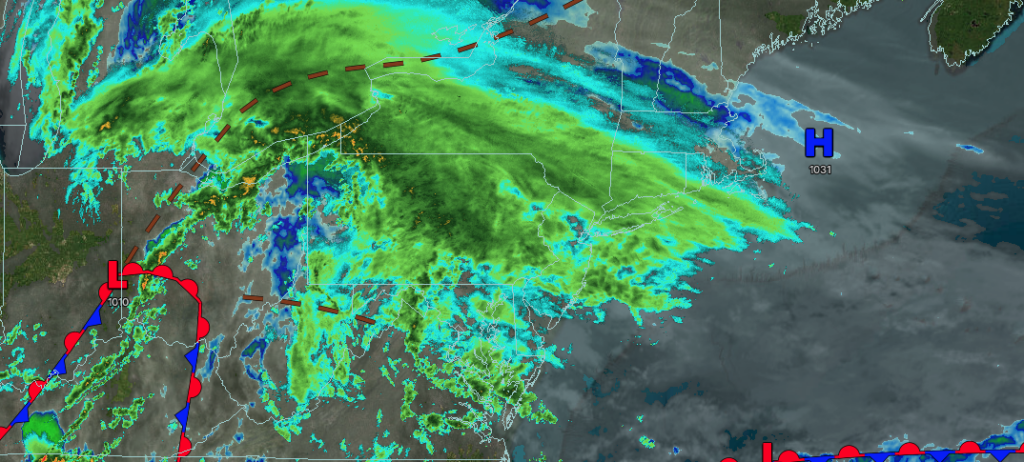
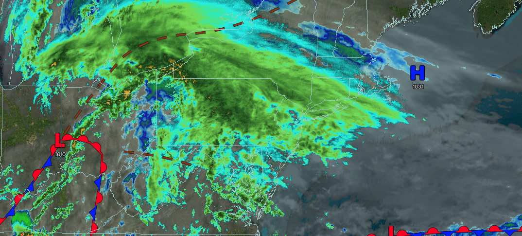
Waves of heavy rainfall will continue through tomorrow morning. Some localized urban flooding will be a threat this weekend.
TODAY
A stalling warm front will produce waves of moderate to heavy rainfall. Winds will be from the east at 5 to 15 mph. High temperatures will range from the mid to upper 40s over the interior and lower to mid-50s along the coast.
TONIGHT
A warm front will produce waves of moderate to heavy rainfall. Winds will be from the east at 5 to 15 mph. Low temperatures will range from the mid to upper 40s over the interior and lower to mid-50s along the coast.
TOMORROW
An area of low pressure will produce periods of heavy rain in the morning. Overcast skies and scattered showers are expected in the afternoon. Winds will be from the northeast at 5 to 15 mph. High temperatures will range from the upper 50s to lower 60s over the interior and Long Island and mid to upper 60s on the I-95 corridor.
TOMORROW NIGHT
A cold front will approach from the west with variable cloud cover and isolated showers. Winds will veer to the northwest at 1 to 5 mph. Low temperatures will range from the mid to upper 50s over the interior and upper 50s to lower 60s along the coast.
MEMORIAL DAY MONDAY
A cold front will approach from the west with variable cloud cover and isolated showers. Winds will veer to the northwest at 1 to 5 mph. High temperatures will range from the lower to mid-70s over the interior and Long Island, mid to upper 70s elsewhere.
TUESDAY
A trough will produce scattered clouds and isolated showers. Winds will be light and variable. Low temperatures will range from the mid to upper 50s over the interior and lower to mid-60s along the coast. High temperatures will range from the mid to upper 70s.
WEDNESDAY
A trough will produce scattered clouds and isolated showers. Low temperatures will range from the mid to upper 50s over the interior and lower to mid-60s along the coast. High temperatures will range from the mid to upper 70s over the interior and Long Island, and upper 70s to lower 80s on the I-95 corridor.
THURSDAY
A trough will produce scattered clouds and isolated showers. Low temperatures will range from the upper 40s to the lower 50s over the interior and mid to upper 50s along the coast. High temperatures will range from the mid to upper 60s over the interior and Long Island and upper 60s to lower 70s on the I-95 corridor.
FRIDAY
A back door cold front will produce periods of rain along the coast and scattered showers over the interior. Low temperatures will range from the upper 50s to lower 60s over the interior and Long Island, mid to upper 60s in the New York City metropolitan area, and upper 60s to lower 70s in the Philadelphia metropolitan area.
SATURDAY
A trough will produce scattered clouds and isolated showers. Low temperatures will range from the mid to upper 40s over the interior and lower to mid-50s along the coast. High temperatures will range from the upper 50s to lower 60s on Long Island and mid to upper 60s elsewhere.


