


UPDATED 05/20/26 9:46 AM
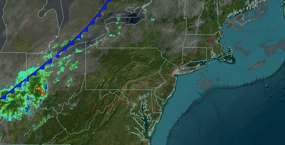
Hot and humid weather conditions will come to an end this afternoon with showers and strong thunderstorms. A cool, damp weather pattern takes over for the Memorial Day Weekend.
TODAY
A cold front will approach the region with increasing clouds and some morning fog. Scattered showers and strong thunderstorms are likely in the evening. The thunderstorms will be capable of heavy downpours, frequent lightning, and wind gusts over 45 mph. Winds will be from the southwest at 5 to 15 mph. High temperatures will range from the mid to upper 80s on southeastern Long Island, lower to mid-90s in northwestern Long Island, mid to upper 90s on the I-95 corridor, mid-80s to lower 90s over the interior, and lower to mid-80s in the Poconos and Catskills.
TONIGHT
A cold front will gradually sink southward with waves of showers and thunderstorms. Winds will veer to the northwest at 5 to 15 mph. Low temperatures will range from the upper 40s to lower 50s over the interior and lower to mid-50s along the coast.
TOMORROW
A cold front will clear the region with showers and thunderstorms in the morning. Skies will clear from north to south in the afternoon and evening. Winds will veer to the northeast at 5 to 15 mph. High temperatures will range from the lower to mid-60s.
TOMORROW NIGHT
High pressure will produce scattered clouds. Winds will be from the east at 5 to 15 mph. Low temperatures will range from the lower to mid-40s over the interior and upper 40s to lower 50s along the coast.
FRIDAY
High pressure will produce scattered clouds. Winds will be from the east at 5 to 15 mph. High temperatures will range from the lower to mid-60s.
SATURDAY
A warm front will approach the region with increasing clouds and scattered showers. Winds will be from the east at 5 to 15 mph. Low temperatures will range from the mid to upper 40s over the interior and upper 40s to the lower 50s along the coast. High temperatures will range from the upper 40s to lower 50s over the interior and lower to mid-50s along the coast.
SUNDAY
An area of low pressure will produce overcast skies and scattered showers. Low temperatures will range from the mid to upper 40s over the interior and upper 40s to lower 50s along the coast. High temperatures will range from the mid to upper 50s over the interior and Long Island and lower to mid-60s on the I-95 corridor.
MEMORIAL DAY MONDAY
A stationary front will produce variable clouds and widely scattered showers. Low temperatures will range from the lower to mid-50s over the interior and mid to upper 50s along the coast. High temperatures will range from the mid to upper 60s on Long Island and lower to mid-70s elsewhere.
TUESDAY
A trough will produce scattered clouds and isolated showers. Low temperatures will range from the lower to mid-50s over the interior and upper 50s to lower 60s along the coast. High temperatures will range from the upper 60s to lower 70s over the interior and lower to mid-70s along the coast.
WEDNESDAY
A cold front will produce scattered clouds and isolated showers. Low temperatures will range from the mid to upper 50s over the interior and upper 50s to lower 60s along the coast. High temperatures will range from the mid to upper 70s over the interior and upper 70s to lower 80s along the coast.