

UPDATED 04/28/26 9:37 AM
Increasing clouds and isolated showers through tomorrow will give way to periods of rain tomorrow night. A cool unsettled weather pattern continues through next week.
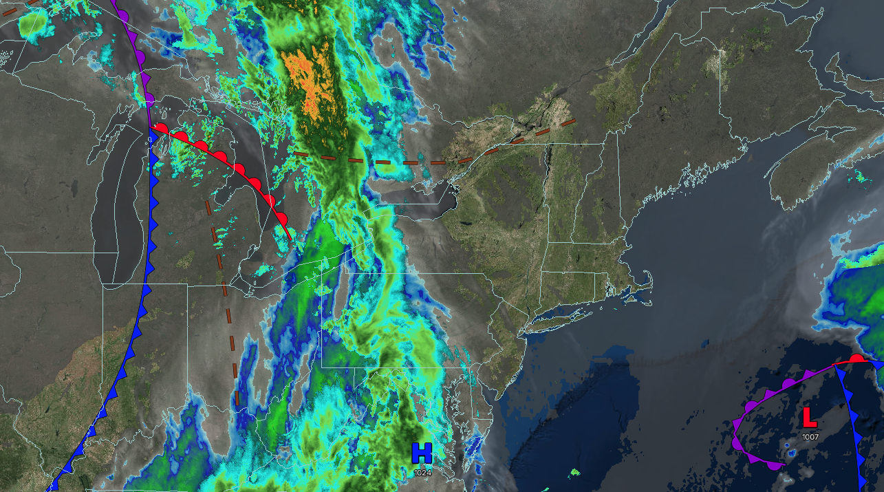
TODAY
High pressure will exit the region as clouds increase. Winds will be from the northeast at 5 to 15 mph. High temperatures will range from the lower to mid-60s.
TONIGHT
A trough will approach the region with increasing clouds and isolated showers. Winds will be from the southeast at 5 to 15 mph. Low temperatures will range from the lower to mid-40s over the interior and suburbs and upper 40s to lower 50s in urban areas.
TOMORROW
A cold front will approach the region with increasing clouds and isolated showers. Winds will back to the east at 5 to 15 mph. High temperatures will range from the mid to upper 50s over the interior and New York City metropolitan area and upper 50s to lower 60s in the Philadelphia metropolitan area.
TOMORROW NIGHT
A cold front and area of low pressure will produce periods of rain. Winds will be from the east at 5 to 15 mph. Low temperatures will range from the lower to mid-40s over the interior and upper 40s to lower 50s along the coast.
THURSDAY
An area of low pressure will exit the region with periods of rain in the morning, followed by clearing skies. Winds will back to the northwest at 10 to 20 mph. High temperatures will range from the lower to mid-50s over the interior, upper 50s to lower 60s in the New York City metropolitan area, and lower to mid-60s in the Philadelphia metropolitan area.
FRIDAY
A series of troughs will pass through the region with scattered clouds and isolated showers. Winds will be from the west at 5 to 15 mph. Low temperatures will range from the lower to mid-30s over the interior, upper 30s to lower 40s in the suburbs, and lower to mid-40s in urban areas. High temperatures will range from the lower to mid-50s over the interior, mid to upper 50s in the New York City metropolitan area, and upper 50s to lower 60s in the Philadelphia metropolitan area.
SATURDAY
High pressure will produce scattered clouds. Low temperatures will range from the lower to mid-30s over the interior and from the upper 30s to the lower 40s along the coast. High temperatures will range from the mid- to upper 40s over the interior to the lower to mid-50s along the coast.
SUNDAY
High pressure will produce scattered clouds. Low temperatures will range from the lower to mid-30s over the interior and from the upper 30s to the lower 40s along the coast. High temperatures will range from the lower to mid-50s over the interior, mid to upper 50s in the New York City metropolitan area, and upper 50s to lower 60s in the Philadelphia metropolitan area.
MONDAY
High pressure will produce scattered clouds. Low temperatures will range from the upper 30s to lower 40s over the interior and lower to mid-40s along the coast. High temperatures will range from the lower to mid-60s over the interior and New York City metropolitan area and mid to upper 60s in the Philadelphia metropolitan area.
TUESDAY
A cold front will produce scattered showers. Low temperatures will range from the mid to upper 40s over the interior and upper 40s to lower 50s along the coast. High temperatures will range from the lower to mid-60s on Long Island, upper 60s to lower 70s in the New York City and Philadelphia metropolitan areas, and mid to upper 60s over the interior.

