

UPDATED 04/27/26 10:51 AM
Excellent weather conditions will begin the week, but an active and cool weather pattern will return by mid-week and continue into the weekend.
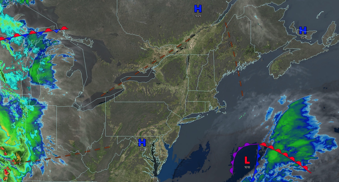
TODAY
High pressure will produce scattered clouds. Winds will be from the northeast at 5 to 15 mph. High temperatures will range from the mid to upper 60s.
TONIGHT
High pressure will produce scattered clouds. Winds will be from the northeast at 5 to 15 mph. Low temperatures will range from the lower to mid-40s.
TOMORROW
A warm front will approach the region with increasing clouds. Winds will be from the northeast at 5 to 15 mph. High temperatures will range from the lower to mid-60s over the interior and mid to upper 60s along the coast.
TOMORROW NIGHT
A stalling warm front will produce scattered clouds and isolated showers. Winds will veer to the southeast at 5 to 15 mph. Low temperatures will range from the lower to mid-40s over the interior and suburbs and upper 40s to lower 50s in urban areas.
WEDNESDAY
A stationary front will produce variable clouds and isolated showers through the afternoon. A cold front and area of low pressure will produce periods of rain in the evening and overnight. Winds will back to the east at 5 to 15 mph. High temperatures will range from the lower to mid-60s over the interior and New York City metropolitan area and mid to upper 60s in the Philadelphia metropolitan area.
THURSDAY
An area of low pressure will exit the region with periods of rain in the morning, followed by clearing skies. Winds will back to the northwest at 10 to 20 mph. Low temperatures will range from mid to upper 40s over the interior and upper 40s to lower 50s along the coast. High temperatures will range from the lower to mid-50s over the interior and upper 50s to lower 60s along the coast.
FRIDAY
High pressure will produce scattered clouds. Low temperatures will range from the mid to upper 30s over the interior and lower to mid-40s along the coast. High temperatures will range from the lower to mid-50s over the interior and mid to upper 50s along the coast.
SATURDAY
A trough will produce scattered clouds and widely scattered showers. Low temperatures will range from the upper 30s to lower 40s over the interior and mid-40s along the coast. High temperatures will range from the lower to mid-50s over the interior and upper 50s to lower 60s along the coast.
SUNDAY
High pressure will produce scattered clouds. Low temperatures will range from the lower to mid-30s over the interior and upper 30s to lower 40s along the coast. High temperatures will range from the upper 40s to lower 50s over the interior and lower to mid-50s along the coast.
MONDAY
High pressure will produce scattered clouds. Low temperatures will range from the upper 30s to the lower 40s. High temperatures will range from the upper 50s to lower 60s over the interior and New York City metropolitan area and mid to upper 60s in the Philadelphia metropolitan area.

