

UPDATED 04/25/26 10:32 AM
Periods of rain through tomorrow morning will be the first of several rainfall events as a new weather pattern develops.
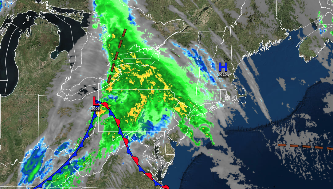
TODAY
An area of low pressure will approach the region with showers becoming widespread by the afternoon. Winds will be from the southeast at 5 to 15 mph. High temperatures will range from the lower to mid-40s over the interior, mid to upper 40s on Long Island, upper 40s to lower 50s in the New York City metropolitan area, and mid to upper 50s in the Philadelphia metropolitan area.
TONIGHT
An area of low pressure will produce periods of rain. Winds will back to the northeast at 10 to 20 mph with gusts up to 40 mph. Low temperatures will range from the upper 30s to the lower 40s over the interior and from the lower to mid-40s along the coast.
TOMORROW
An area of low pressure will produce periods of rain in the morning. Skies will gradually clear with lingering showers in the afternoon and evening. Winds will be from the northeast at 10 to 20 mph. High temperatures will range from the lower to mid-50s on Long Island, mid to upper 50s in the New York City and Philadelphia metropolitan areas, and upper 50s to the lower 60s over the interior.
TOMORROW NIGHT
High pressure will build into the region with clearing skies. Winds will be from the northeast at 5 to 15 mph. Low temperatures will range from the upper 30s to the lower 40s over the interior and from the lower to mid-40s along the coast.
MONDAY
High pressure will build into the region with clearing skies. Winds will be from the northeast at 5 to 15 mph. High temperatures will range from the lower to mid-60s.
TUESDAY
High pressure will exit the region as clouds increase. Winds will be from the northeast at 5 to 15 mph. Low temperatures will range from the upper 30s to the lower 40s over the interior and from the lower to mid-40s along the coast. High temperatures will range from the lower to mid-60s.
WEDNESDAY
A cold front will stall over the region with variable clouds and widely scattered showers. Low temperatures will range from the mid to upper 40s over the interior and suburbs, and from the upper 40s to the lower 50s in urban areas. High temperatures will range from the upper 50s to the lower 60s over the interior and Long Island, and from the mid to upper 60s in the New York City and Philadelphia metropolitan areas.
THURSDAY
A stalled frontal boundary will produce variable clouds and isolated showers. Low temperatures will range from the lower to mid-50s. High temperatures will range from the lower to mid-60s over the interior, mid to upper 60s on Long Island, and upper 60s to lower 70s in the New York City and Philadelphia metropolitan areas.
FRIDAY
High pressure will produce scattered clouds. Low temperatures will range from the upper 30s to lower 40s over the interior and mid-40s along the coast. High temperatures will range from the mid to upper 50s over the interior and upper 50s to lower 60s along the coast.
SATURDAY
A trough will produce scattered clouds and isolated showers. Low temperatures will range from the lower to mid-30s over the interior and from the upper 30s to the lower 40s along the coast. High temperatures will range from the mid- to upper 40s over the interior to the lower to mid-50s along the coast.

