

UPDATED 04/10/26 9:24 AM
Seasonable conditions return for the weekend after a chilly week. A shift to summer-like conditions is expected by next week!
TODAY
High pressure will produce scattered clouds. Winds will be from the southwest at 5 to 10 mph. High temperatures will range from the mid to upper 50s in southeastern Long Island, lower to mid-60s in northwestern Long Island, and mid to upper 60s elsewhere.
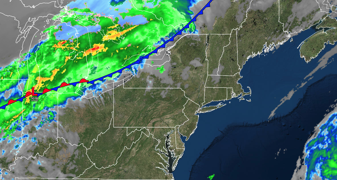
TONIGHT
A cold front will move through the region with variable clouds and widely scattered showers. Winds will be from the southwest at 5 to 10 mph. Low temperatures will range from the upper 30s to lower 40s over the interior, mid to upper 40s in the suburbs, and upper 40s to lower 50s in urban areas.
TOMORROW
High pressure will build into the region with clearing skies. Winds will veer to the northwest at 5 to 10 mph. High temperatures will range from the lower to mid-50s in higher elevations, mid to upper 50s over the interior, and lower to mid-60s elsewhere.
TOMORROW NIGHT
High pressure will pass over the region with clear skies. Winds will be from the north at 1 to 5 mph. Low temperatures will range from the lower to mid-30s over the interior and upper 30s to lower 40s along the coast.
SUNDAY
High pressure will produce scattered clouds. Winds will veer to the east at 5 to 10 mph. High temperatures will range from the lower to mid-50s over the interior, lower to mid-50s in southeastern Long Island, mid to upper 50s in northwestern Long Island, and lower to mid-60s in the Philadelphia and New York City metropolitan area.
MONDAY
A warm front will produce scattered showers and variable clouds. Winds will veer to the southwest at 5 to 15 mph. Low temperatures will range from the mid to upper 40s over the interior, upper 40s to lower 50s in the suburbs, and lower to mid-50s in urban areas. High temperatures will range from the mid to upper 60s in southeastern Long Island, lower to mid-70s in northwestern Long Island, upper 70s to lower 80s in the New York City metropolitan area, upper 60s to mid70s over the interior, and lower to mid-80s in the Philadelphia metropolitan area.
TUESDAY
A stationary front will produce variable clouds and isolated showers. Low temperatures will range from the mid to upper 50s over the interior and suburbs and upper 50s to lower 60s in urban areas. High temperatures will range from the lower to mid-70s over the interior, mid to upper 70s on Long Island, and upper 70s to lower 80s in the Philadelphia and New York City metropolitan area.
WEDNESDAY
A stationary front will produce scattered clouds and isolated showers. Low temperatures will range from the lower to mid-50s over the interior and suburbs and mid to upper 50s in urban areas. High temperatures will range from the mid to upper 60s in southeastern Long Island, lower to mid-70s in northwestern Long Island, upper 70s to lower 80s over the interior and New York City metropolitan area, and mid to upper 80s in the Philadelphia metropolitan area.
THURSDAY
A stationary front will produce scattered clouds and isolated showers. Low temperatures will range from the mid to upper 50s on Long Island and lower to mid-60s elsewhere. High temperatures will range from the mid to upper 70s in southeastern Long Island, lower to mid-80s in northwestern Long Island, mid to upper 80s over the interior and New York City metropolitan area, and upper 80s to lower 90s in the Philadelphia metropolitan area.
FRIDAY
A stationary front will produce scattered clouds and isolated showers. Low temperatures will range from the upper 50s to the lower 60s over the interior and suburbs, and from the mid to upper 60s in urban areas. High temperatures will range from the upper 70s to lower 80s over the interior, upper 70s to lower 80s on Long Island, and mid to upper 80s in the New York City and Philadelphia metropolitan area.


