

UPDATED 04/07/26 5:14 PM
A deep freeze is expected tonight with temperatures in the 20s and 30s. A shift to a warmer pattern is expected by the end of the week.
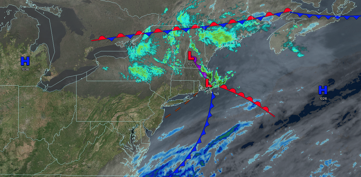
TONIGHT
High pressure will produce clear skies. Winds will be light and variable. Low temperatures will range from the lower to mid-20s over the interior, mid to upper 20s in the suburbs, and upper 20s to lower 30s in urban areas.
TOMORROW
High pressure will produce scattered clouds. Winds will be light and variable. High temperatures will range from the mid to upper 40s on Long Island and upper 40s to lower 50s elsewhere.
TOMORROW NIGHT
High pressure will produce scattered clouds. Winds will be from the southeast at 1 to 5 mph. Low temperatures will range from the upper 20s to lower 30s over the interior and lower to mid-30s along the coast.
THURSDAY
High pressure will produce scattered clouds. Winds will be from the southeast at 5 to 10 mph. High temperatures will range from the mid to upper 40s in southeastern Long Island, lower to mid-50s in northwestern Long Island, mid to upper 50s in the New York City and Philadelphia metropolitan areas, and lower to mid-50s over the interior.
FRIDAY
High pressure will produce scattered clouds. Winds will be from the southwest at 5 to 10 mph. Low temperatures will range from the upper 30s to the lower 40s. High temperatures will range from the mid to upper 50s in southeastern Long Island, lower to mid-60s in northwestern Long Island, and upper 60s to lower 70s elsewhere.
SATURDAY
A cold front will produce scattered showers in the morning, followed by clearing skies. Low temperatures will range from the upper 30s to lower 40s over the interior, mid to upper 40s in the suburbs, and lower to mid-50s in urban areas. High temperatures will range from the mid to upper 50s over the interior, lower to mid-60s in the New York City metropolitan area, and mid to upper 60s in the Philadelphia metropolitan area.
SUNDAY
High pressure will produce scattered clouds. Low temperatures will range from the lower to mid-30s over the interior and upper 30s to lower 40s along the coast. High temperatures will range from the mid to upper 50s on Long Island, lower to mid-60s in the Philadelphia and New York City metropolitan area, and upper 50s to lower 60s over the interior.
MONDAY
A trough will produce scattered clouds and isolated showers. Low temperatures will range from the mid to upper 40s. High temperatures will range from the upper 50s to lower 60s in southeastern Long Island, mid to upper 60s in northwestern Long Island, and lower to mid-70s elsewhere.
TUESDAY
A trough will produce scattered clouds and isolated showers. Low temperatures will range from the mid to upper 50s on Long Island and upper 50s to lower 60s elsewhere. High temperatures will range from the upper 60s to lower 70s in southeastern Long Island, mid to upper 70s in northwestern Long Island, lower to mid-80s in the New York City and Philadelphia metropolitan areas and suburbs, and upper 70s to lower 80s over the interior.

