

UPDATED 03/16/26 10:10 AM
Showers, thunderstorms, and strong winds will kick off the week, followed by a quiet but chilly period of weather throughout the rest of the week.
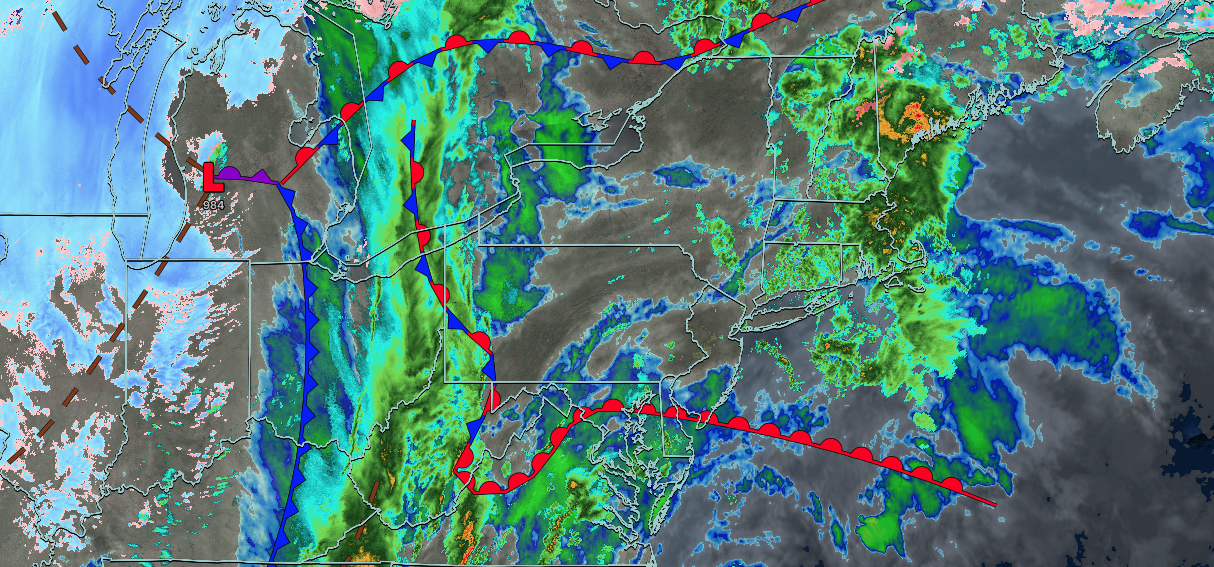
TODAY
A warm front will lift through the region with scattered showers and thunderstorms. A few severe thunderstorms capable of heavy downpours, frequent lightning, hail, wind gusts over 55 mph, and tornadoes are a threat to eastern Pennsylvania. Winds will be from the south at 10 to 20 mph with gusts between 30 and 60 mph. High temperatures will range from the mid to upper 50s on Long Island, upper 50s to lower 60s along the coast, and lower to mid-60s elsewhere.
THIS EVENING
The cold front will move through the region with heavy rain and thunderstorms. A squall line will produce intense downpours, wind gusts over 40 mph, and frequent lightning. Wind damage, power outages, and poor driving conditions are expected through the evening rush hour. Winds will veer from the south to the west at 15 to 30 mph with gusts between 40 and 70 mph. Temperatures will fall through the 60s, 50s, and 40s.
TONIGHT
The cold front will exit with clearing skies after midnight. Winds will be from the west at 10 to 20 mph with gusts between 30 and 50 mph. Low temperatures will range from the lower to mid-20s over the interior, upper 20s to lower 30s in the suburbs, and lower to mid-30s in urban areas.
TOMORROW
High pressure will build into the region with clearing skies. Winds will be from the west at 10 to 20 mph. High temperatures will range from the upper 20s to lower 30s for higher elevations, mid to upper 30s over the interior, and upper 30s to lower 40s along the coast.
TOMORROW NIGHT
A trough will produce scattered clouds. Winds will be from the west at 5 to 15 mph. Low temperatures will range from the mid to upper 10s over the interior, upper 10s to lower 20s in the suburbs, and lower to mid-20s in urban areas.
WEDNESDAY
High pressure will produce scattered clouds. Winds will be light and variable. High temperatures will range from the mid to upper 30s.
THURSDAY
High pressure will produce scattered clouds. Winds will be from the south at 5 to 15 mph. Low temperatures will range from the mid to upper 20s over the interior and upper 20s to lower 30s along the coast. High temperatures will range from the upper 30s to the lower 40s over the interior and from the lower to mid-40s along the coast.
FRIDAY
A warm front will produce increasing clouds with scattered showers by the evening. Low temperatures will range from the lower to mid-30s. High temperatures will range from the mid to upper 40s over the interior, upper 40s to lower 50s in the New York City metropolitan area, and mid to upper 50s in the Philadelphia metropolitan area.
SATURDAY
A stationary front will produce variable clouds and scattered showers. Low temperatures will range from the lower to mid-40s. High temperatures will range from the upper 50s to lower 60s over the interior and mid to upper 60s along the coast.
SUNDAY
A cold front will approach the region with scattered showers. Low temperatures will range from the lower to mid-30s over the interior, upper 30s to lower 40s in suburbs, and mid to upper 40s in urban areas. High temperatures will range from the mid to upper 40s on Long Island and lower to mid-50s elsewhere.
MONDAY
A cold front will exit the region in the morning, followed by clearing skies in the afternoon and evening. Low temperatures will range from the mid to upper 40s. High temperatures will range from the mid to upper 40s.


