

UPDATED 03/03/26 5:50 PM
An icy mix will linger in Connecticut, but warm air will overwhelm the region with periods of showers throughout the week.
TONIGHT
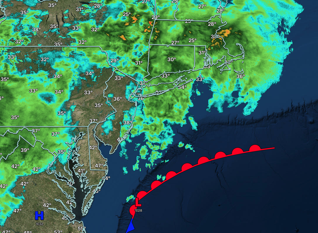
An area of low pressure and a stationary front will produce freezing drizzle, freezing rain, and sleet in Connecticut and the Hudson River Valley through this evening. Showers and drizzle will linger through tomorrow morning. Winds will veer to the southwest at 5 to 10 mph. Low temperatures will range from the lower 30s in Connecticut and the Hudson River Valley and mid to upper 30s elsewhere.
TOMORROW
A stationary front will produce variable clouds and scattered showers. Winds will veer to the east at 5 to 10 mph. High temperatures will range from the lower to mid-50s.
TOMORROW NIGHT
A stationary front will linger over the region with variable clouds and scattered showers. Winds will be from the east at 1 to 5 mph. Low temperatures will range from the upper 30s to the lower 40s.
THURSDAY
A stationary front will linger over the region with variable clouds and scattered showers. Winds will be from the east at 1 to 5 mph. High temperatures will range from the mid to upper 40s over the interior and Long Island, upper 40s to lower 50s in the New York City metropolitan area, and mid to upper 50s in the Philadelphia metropolitan area.
FRIDAY
An area of low pressure along the stationary front will produce scattered to widespread showers in the morning. Skies will clear in the afternoon and evening. Winds will be from the northeast at 5 to 10 mph. Low temperatures will range from the mid to upper 30s. High temperatures will range from the mid to upper 40s over the interior and upper 40s to lower 50s along the coast.
SATURDAY
A trough will produce scattered clouds and isolated showers. Low temperatures will range from the upper 30s to the lower 40s. High temperatures will range from the lower to mid-50s on Long Island, upper 50s to lower 60s in the New York City metropolitan area, and lower to mid-60s over the interior and Philadelphia metropolitan area.
SUNDAY
A cold front will produce scattered showers in the morning. Skies will clear in the afternoon. Low temperatures will range from the upper 40s to lower 50s over the interior, lower to mid-50s in the suburbs, and mid to upper 50s in urban areas. High temperatures will range from the upper 50s to lower 60s over the interior and lower to mid-60s along the coast.
MONDAY
A trough will produce scattered clouds and isolated showers. Low temperatures will range from the lower to mid-40s. High temperatures will range from the upper 50s to lower 60s over the interior, lower to mid-60s in the New York City metropolitan area, and mid to upper 60s in the Philadelphia metropolitan area.
TUESDAY
A trough will produce scattered clouds and isolated showers. Low temperatures will range from the lower to mid-30s. High temperatures will range from the lower to mid-50s on Long Island, upper 50s to lower 60s in the New York City metropolitan area and interior, and mid to upper 60s in the Philadelphia metropolitan area.

