

UPDATED 03/02/26 9:59 AM
Chilly conditions today will give way to warmer conditions as warm air gradually invades the region. A short wintry mix tomorrow morning will give way to waves of rainfall through the rest of the week and into next weekend.
TODAY
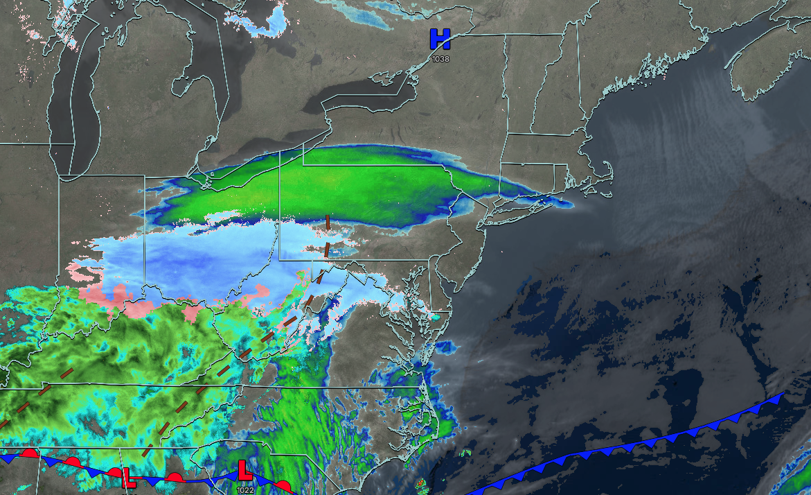
High pressure will exit the region with increasing cloud cover. Winds will be from the northeast at 1 to 5 mph. High temperatures will range from the lower to mid-30s over the interior, lower to mid-30s in the New York City metropolitan area, and mid to upper 30s in the Philadelphia metropolitan area.
TONIGHT
A warm front will approach with cloudy skies and snow showers developing towards daybreak. Winds will veer to the southeast at 1 to 5 mph. Low temperatures will range from the lower to mid-20s over the interior and upper 20s to lower 30s along the coast.
TOMORROW
A warm front will lift through the region with snow mixing over to rain quickly to the northwest of the I-95 corridor, with snow accumulation of a coating to 2″ and up to 0.05″ of ice. Showers are expected along and southeast of the I-95 corridor. Winds will be from the south at 1 to 5 mph. High temperatures will range from the upper 30s to lower 40s over the interior, lower to mid-40s in the New York City metropolitan area, and mid to upper 40s in the Philadelphia metropolitan area.
TOMORROW NIGHT
A warm front will be to the north of the region with variable clouds and scattered showers. Winds will be from the southwest at 5 to 10 mph. Low temperatures will range from the mid to upper 30s over the interior and upper 30s to lower 40s along the coast.
WEDNESDAY
A cold front will approach the region with variable cloud cover and scattered showers. Winds will be from the east at 5 to 10 mph. High temperatures will range from the lower to mid-50s over the interior and mid to upper 50s along the coast.
THURSDAY
A stationary front will linger over the region with variable clouds and scattered showers. Winds will be from the east at 1 to 5 mph. Low temperatures will range from the mid to upper 30s over the interior and upper 30s to lower 40s along the coast. High temperatures will range from the mid to upper 40s on Long Island and Connecticut, upper 40s to lower 50s over the interior and New York City metropolitan area, and mid to upper 50s in the Philadelphia metropolitan area.
FRIDAY
An area of low pressure along the stationary front will produce scattered to widespread showers. Low temperatures will range from the upper 30s to the mid-40s. High temperatures will range from the mid to upper 40s on Long Island and Connecticut, upper 40s to lower 50s over the interior and New York City metropolitan area, and lower to mid-50s in the Philadelphia metropolitan area.
SATURDAY
A stationary front will produce variable clouds and scattered showers. Low temperatures will range from the upper 30s to the lower 40s. High temperatures will range from the mid to upper 50s on Long Island and Connecticut, lower to mid-60s over the interior and New York City metropolitan area, and mid to upper 60s in the Philadelphia metropolitan area.
SUNDAY
A cold front will produce scattered showers. Low temperatures will range from the lower to mid-40s over the interior, mid to upper 40s in the suburbs, and upper 40s to lower 50s in the urban areas. High temperatures will range from the mid to upper 50s on Long Island and Connecticut and lower to mid-60s throughout the rest of the region.
MONDAY
High pressure will produce clearing skies. Low temperatures will range from the mid to upper 40s over the interior, upper 40s to lower 50s in the New York City metropolitan area, and mid to upper 50s in the Philadelphia metropolitan area. High temperatures will range from the lower to mid-60s over the interior, mid to upper 60s in the New York City metropolitan area, and upper 60s to lower 70s in the Philadelphia metropolitan area.


