

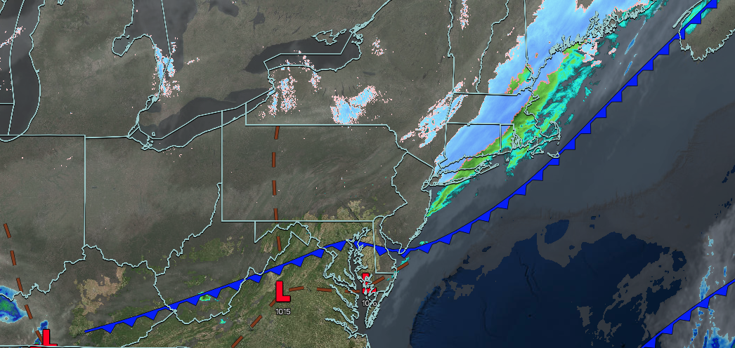
UPDATED 03/01/26 10:15 AM
The first day of meteorological Spring features an arctic cold front with a return to colder weather conditions. However, a warm-up takes hold the rest of the week with unsettled conditions.
TODAY
An arctic cold front will produce scattered snow showers. Winds will veer to the northwest at 5 to 10 mph. High temperatures will range from the upper 20s to lower 30s over the interior, lower to mid-30s in the New York City metropolitan area, and upper 30s to lower 40s in the Philadelphia metropolitan area.
TONIGHT
High pressure will build into the region with clearing skies. Winds will be from the north at 5 to 10 mph. Low temperatures will range from the single digits to the lower 10s over the interior and the lower to mid-10s along the coast.
TOMORROW
High pressure will pass to the north with scattered clouds through the afternoon. An area of low pressure will produce scattered snow showers in the evening. Winds will be from the northeast at 1 to 5 mph. High temperatures will range from the mid-20s to the lower 30s.
TOMORROW NIGHT
A warm front will approach the region with increasing clouds and scattered snow showers. Winds will be from the southeast at 1 to 5 mph. Low temperatures will range from the upper 10s to lower 20s over the interior and lower to mid-20s along the coast.
TUESDAY
A warm front will lift through the region with snow mixing over to sleet and then rain. Some snow accumulation is expected in all regions before a changeover to rain. Winds will be from the south at 1 to 5 mph. High temperatures will range from the mid to upper 30s over the interior and upper 30s to lower 40s along the coast.
WEDNESDAY
A cold front will stall over the region with periods of showers. Winds will veer to the east at 5 to 10 mph. Low temperatures will range from the upper 20s to lower 30s over the interior and lower to mid-30s along the coast. High temperatures will range from the lower to mid-40s over the interior, lower to mid-40s in the New York City metropolitan area, and mid to upper 40s in the Philadelphia metropolitan area.
THURSDAY
A stationary front will produce variable clouds and scattered showers. Low temperatures will range from the mid to upper 20s over the interior and lower to mid-30s along the coast. High temperatures will range from the upper 30s to the lower 40s.
FRIDAY
An area of low pressure along the stationary front will produce periods of rain. Low temperatures will range from the lower to mid-30s over the interior and mid to upper 30s along the coast. High temperatures will range from the lower to mid-40s over the interior, lower to mid-40s in the New York City metropolitan area, and mid to upper 40s in the Philadelphia metropolitan area.
SATURDAY
A stationary front will produce variable clouds and scattered showers. Low temperatures will range from the mid to upper 30s. High temperatures will range from the lower to mid-50s in Connecticut and Long Island, the upper 50s to lower 60s over the interior and the New York City metropolitan area, and the lower to mid-60s in the Philadelphia metropolitan area.
SUNDAY
High pressure will produce scattered clouds. Low temperatures will range from the mid to upper 30s over the interior, lower to mid-40s in the suburbs, and upper 40s to the lower 50s in urban areas. High temperatures will range from the mid to upper 50s over the interior, upper 50s to lower 60s in the New York City metropolitan area, and lower to mid-60s in the Philadelphia metropolitan area.


