

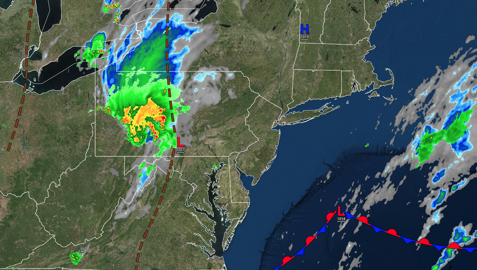
Strong thunderstorms are likely this afternoon and evening with the potential for heavy downpours, frequent lightning, and wind gusts over 55 mph. By mid-week, a hot and humid weather pattern will take hold with a dangerous heat index over 100 degrees.
TODAY
A cold front will approach the region with broken cloud cover and scattered showers and thunderstorms. Winds will veer to the southwest at 5 to 15 mph. Temperatures will rise into the lower to mid-80s over the interior and along the coast and upper 80s to lower 90s in the Delaware River Valley for highs.
TONIGHT
A trough will linger over the region with areas of fog developing towards morning. Winds will be from the southwest at 5 to 15 mph. Temperatures will fall into the upper 60s to lower 70s for lows.
TOMORROW
A trough will linger over the region with areas of fog in the morning and scattered clouds and isolated thunderstorms in the afternoon. Winds will be from the southwest at 5 to 15 mph. Temperatures will rise into the mid to upper 80s over the interior and along the coast and lower to mid-90s in the Delaware River Valley for highs. A heat index over 100 degrees will be a threat.
TOMORROW NIGHT
A trough will linger over the region with areas of fog developing towards morning. Winds will be from the southwest at 5 to 15 mph. Temperatures will fall into the lower to mid-70s for lows.
THURSDAY
A trough will linger over the region with areas of fog in the morning and scattered clouds and isolated thunderstorms in the afternoon. Winds will be from the southwest at 5 to 15 mph. Temperatures will rise into the upper 80s to lower 90s over the interior, mid to upper 90s in the Delaware River Valley, and mid-80s to lower 90s along the coast for highs. A heat index over 100 degrees will be a threat.
FRIDAY
A trough will linger over the region with areas of fog in the morning and scattered clouds and isolated thunderstorms in the afternoon. Winds will be from the southwest at 5 to 15 mph. Temperatures will range from the lower to mid-70s for lows and upper 80s to lower 90s over the interior, mid to upper 90s in the Delaware River Valley, and mid-80s to lower 90s along the coast for highs. A heat index over 100 degrees will be a threat.
SATURDAY
A trough will linger over the region with areas of fog in the morning and scattered clouds and isolated thunderstorms in the afternoon. Temperatures will range from the mid to upper 70s over the interior and upper 70s to lower 80s along the coast for lows and upper 80s to lower 90s over the interior and along the coast and mid-90s to lower 100s for highs. A heat index over 100 degrees will be a threat.
SUNDAY
A powerful cold front will produce waves of showers and thunderstorms. Temperatures will range from the mid to upper 60s over the interior and lower to mid-70s along the coast for lows and lower to mid-80s over the interior and along the coast and upper 80s to lower 90s in the Delaware River Valley for highs.
MONDAY
High pressure will be in control with clear skies to scattered clouds. Temperatures will range from the upper 50s to mid-60s over the interior, mid to upper 60s in the suburbs, and lower to mid-70s in urban areas for lows and mid-70s to lower 80s over the interior, lower to mid-80s along the coast, and upper 80s to lower 90s in the Delaware River Valley for highs.
TUESDAY
High pressure will produce clear skies to scattered clouds. Temperatures will range from the mid to upper 50s over the interior and lower to mid-60s along the coast for lows and mid to upper 70s over the interior, upper 70s to lower 80s along the coast, and lower to mid-80s in the Delaware River Valley for highs.


