

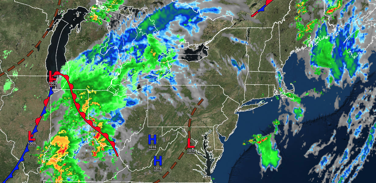
A trough will linger over the region with isolated thunderstorms today followed by another round of thunderstorms tonight through Tuesday.
TODAY
A trough will linger over the region with scattered clouds along with isolated to widely scattered showers and thunderstorms. Winds will be from the south at 5 to 15 mph. Temperatures will rise into the mid to upper 80s over the interior, upper 80s to lower 90s in the Delaware River Valley, and lower to mid-80s along the coast for highs.
TONIGHT
A trough will linger over the region with variable clouds, areas of fog, and isolated showers and thunderstorms. Winds will be from the south-southwest at 5 to 15 mph. Temperatures will fall into the upper 60s to lower 70s for lows.
TOMORROW
A cold front will produce widespread showers and thunderstorms. The thunderstorms will be capable of torrential downpours, hail, frequent lightning, wind gusts over 50 mph, and isolated tornadoes. Winds will be from the southwest at 5 to 15 mph. Temperatures will rise into the upper 70s to lower 80s along the coast and lower to mid-80s away from the coast for highs.
TOMORROW NIGHT
A trough will linger over the region with scattered clouds and widely scattered thunderstorms. Winds will be from the southwest at 5 to 15 mph. Temperatures will fall into the mid to upper 60s over the interior and lower to mid-70s along the coast for lows.
MONDAY
A trough will linger over the region with scattered clouds and widely scattered thunderstorms. Winds will be from the southwest at 5 to 15 mph. Temperatures will rise into the lower to mid-80s over the interior, upper 80s to lower 90s in the Delaware River Valley, and lower to mid-80s along the coast for highs.
TUESDAY
A trough will linger over the region with scattered clouds and isolated to widely scattered thunderstorms. Winds will be from the southwest at 5 to 15 mph. Temperatures will range from the mid to upper 60s over the interior and lower to mid-70s along the coast for lows and lower to mid-80s over the interior, mid to upper 80s in the Delaware River Valley, and lower to mid-80s along the coast for highs.
WEDNESDAY
A trough will linger over the region with scattered clouds and isolated to widely scattered thunderstorms. Temperatures will range from the lower to mid-60s over the interior and mid to upper 60s along the coast for lows and lower to mid-80s over the interior, upper 80s to lower 90s in the Delaware River Valley, and lower to mid-80s along the coast for highs.
THURSDAY
A cold front will approach the region with scattered clouds and widely scattered thunderstorms. Temperatures will range from the lower to mid-60s over the interior, upper 60s to lower 70s in the suburbs, and lower to mid-70s in the urban areas for lows and mid to upper 80s over the interior, upper 80s to lower 90s in the Delaware River Valley, and lower to mid-80s along the coast for highs.
FRIDAY
A stalled cold front will produce waves of showers and thunderstorms. Temperatures will range from the mid to upper 60s over the interior and lower to mid-70s along the coast for lows and lower to mid-80s over the interior, upper 80s to mid-90s in the Delaware River Valley, and mid to upper 80s along the coast for highs.
SATURDAY
A stalled cold front will produce waves of showers and thunderstorms. Temperatures will range from the mid to upper 60s for lows and upper 70s to lower 80s over the interior, mid to upper 80s in the Delaware River Valley, and lower to mid-80s for highs.


