

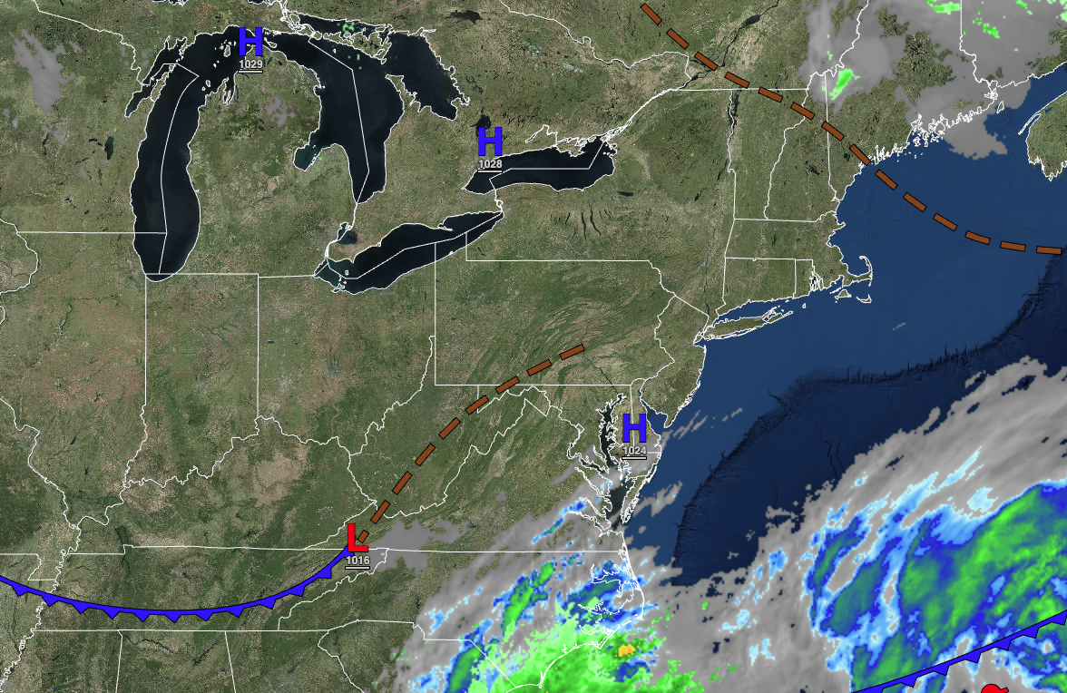
Excellent weather conditions are expected for most of the region this Memorial Day Weekend, but extreme southern New Jersey may not be so lucky.
TODAY
High pressure will produce clear skies to scattered clouds. Winds from the northeast at 5 to 15 mph. Temperatures will rise into the mid to upper 60s over the interior, upper 60s to lower 70s along the coast, and lower to mid-70s in the Delaware River Valley for highs.
TONIGHT
High pressure will produce clear skies to scattered clouds. Winds will be from the northeast at 5 to 15 mph. Temperatures will fall into the lower to mid-50s for lows.
TOMORROW
High pressure will produce clear skies over the interior and scattered clouds along the coast. Winds will be from the northeast at 5 to 15 mph. Temperatures will rise into the lower to mid-70s along the coast and mid to upper 70s away from the coast for highs.
TOMORROW NIGHT
High pressure will produce clear skies to scattered clouds. Winds will be from the northeast at 5 to 15 mph. Temperatures will fall into the lower to mid-50s for lows.
SUNDAY
High pressure will produce clear skies over the interior and scattered clouds along the coast. An area of low pressure well south of the region will produce scattered showers for extreme southeastern New Jersey, south of Atlantic City. Winds will be from the east at 5 to 15 mph. Temperatures will rise into the lower to mid-70s along the coast and mid-70s to lower 80s away from the coast for highs.
MEMORIAL DAY
High pressure will produce clear skies over the interior and scattered clouds along the coast. An area of low-pressure well south of the region will produce scattered showers around Atlantic City to the southern suburbs of Philadelphia and periods of rain in extreme southeastern New Jersey in Cape May County, heavy at times. Rainfall amounts over 0.50″ will be possible in Cape May, New Jersey. Temperatures will range from the lower to mid-50s for lows and upper 70s to lower 80s along the coast and mid to upper 80s away from the coast for highs.
TUESDAY
High pressure will produce clear skies over the interior and scattered clouds along the coast. Temperatures will range from the mid to upper 50s for lows and upper 60s to mid-70s on the coast and upper 70s to lower 80s away from the coast for highs.
WEDNESDAY
High pressure will produce clear skies over the interior and scattered clouds along the coast. Temperatures will range from the mid to upper 50s for lows and lower to mid-70s on Long Island, upper 70s to lower 80s along the coast, and lower to mid-80s away from the coast for highs.
THURSDAY
High pressure will produce clear skies over the interior and scattered clouds along the coast. Temperatures will range from the upper 50s to lower 60s for lows and mid-70s to lower 80s on Long Island, lower to mid-80s on the coast, mid to upper 80s over the interior, and upper 80s to lower 90s in the Delaware River Valley.
FRIDAY
High pressure will produce clear skies over the interior and scattered clouds along the coast. Temperatures will range from the upper 50s to lower 60s over the interior and lower to mid-60s along the coast for lows and mid to upper 80s along the coast, upper 80s to lower 90s over the interior, and lower to mid-90s in the Delaware River Valley for highs.


