

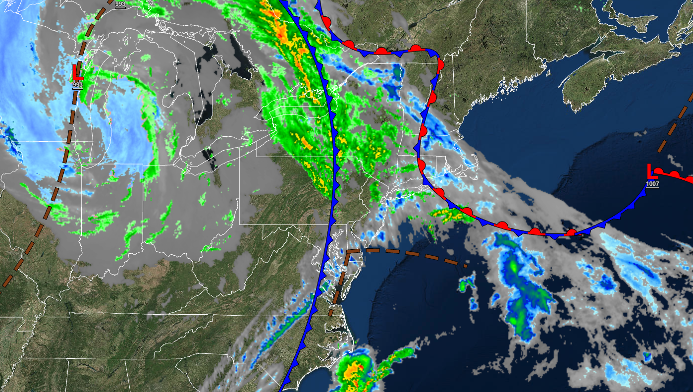
A cold front this morning will set up an active and cooler weather pattern for the rest of the week.
TODAY
A cold front will move through the region this morning with widely scattered showers and thunderstorms. Winds will veer from the east to the west at 5 to 15 mph. Temperatures will rise into the lower to mid-60s over the interior and mid to upper-60s along the coast for highs.
TONIGHT
A trough will produce scattered clouds and a few isolated showers. Winds will be from the west at 5 to 15 mph. Temperatures will fall into the lower to mid-40s over the interior and upper 40s to lower 50s along the coast for lows.
TOMORROW
A trough will produce scattered clouds with a few isolated showers. Winds will be from the west at 5 to 15 mph. Temperatures will rise into the upper 40s to lower 50s over the interior and mid to upper 50s along the coast for highs.
TOMORROW NIGHT
A trough will produce scattered clouds and isolated showers. Winds will be from the west at 5 to 15 mph. Temperatures will fall into the mid to upper 30s over the interior and upper 30s to mid-40s along the coast for lows.
WEDNESDAY
A trough will exit the region with isolated showers in the morning followed by scattered to few clouds. Winds will be from the west at 5 to 15 mph. Temperatures will rise into the mid-40s to lower 50s over the interior, lower to mid-50s on the coast, and mid-50s to lower 60s in the Delaware River Valley for highs.
THURSDAY
High pressure will produce scattered clouds. Temperatures will range from the lower to mid-30s over the interior, upper 30s to lower 40s in the suburbs, and mid to upper 40s in urban areas for lows and upper 50s to mid-60s over the interior, upper 50s to mid-60s along the coast, and upper 60s to mid-70s in the Delaware River Valley for highs.
FRIDAY
A warm front will lift through the region with scattered clouds and isolated showers. Temperatures will range from the mid to upper 40s for lows and lower to mid-60s on Long Island, upper 60s to mid-70s on the coast, upper 70s to mid-80s in the Delaware River Valley, and mid-60s to lower 70s in the higher elevations for highs.
SATURDAY
A cold front will produce scattered showers and thunderstorms. Temperatures will range from the lower to mid-50s over the interior, lower to mid-50s in suburbs, and upper 50s to lower 60s in urban areas for lows and lower to mid-60s over the interior, mid to upper 60s along the coast, and upper 60s to mid-70s in the Delaware River Valley for highs.
SUNDAY
A trough will produce scattered clouds and isolated showers. Temperatures will range from the lower to mid-40s for lows and upper 40s to lower 50s over the interior, mid to upper 50s along the coast, and upper 50s to mid-60s in the Delaware River Valley for highs.
MONDAY
High pressure will produce scattered clouds. Temperatures will range from the lower to mid-30s over the interior and upper 30s to lower 40s along the coast for lows and upper 40s to lower 50s over the interior, lower to mid-50s along the coast, and mid to upper 50s in the Delaware River Valley for highs.


