


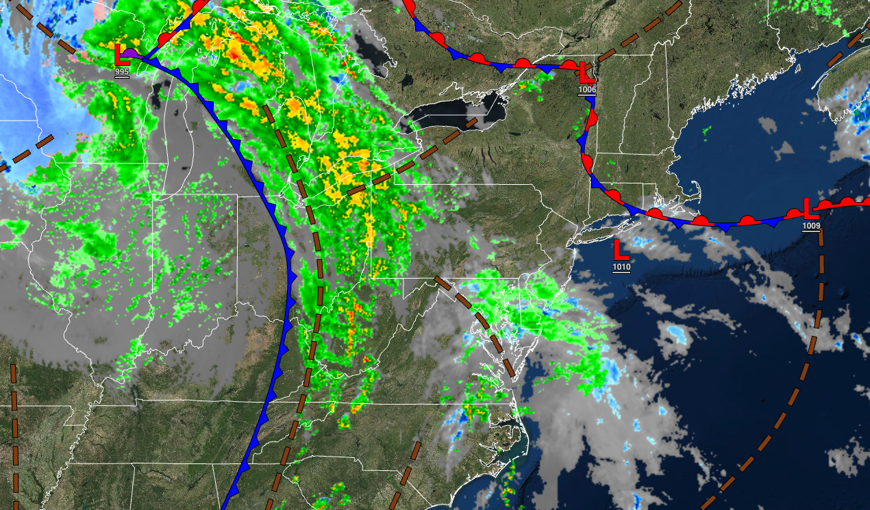
A cool and unsettled weather pattern will continue through the upcoming week with showers and thunderstorms tomorrow morning.
TONIGHT
A cold front will move into the region with waves of showers and thunderstorms. Winds will be from the east at 5 to 15 mph. Temperatures will fall into the lower to mid-50s over the interior, lower to mid-50s in the suburbs, and mid to upper 50s in the urban areas for highs.
TOMORROW
A cold front will exit with showers and thunderstorms in the afternoon followed by scattered clouds and isolated showers in the evening. Winds will be from the southeast at 5 to 15 mph. Temperatures will rise into the lower to mid-60s over the interior and upper 60s to lower 70s along the coast for highs.
TOMORROW NIGHT
A trough will produce cloudy skies and isolated showers. Winds will veer to the west at 5 to 15 mph. Temperatures will fall into the lower to mid-40s over the interior and upper 40s to lower 50s along the coast for lows.
TUESDAY
A trough will produce cloudy skies and isolated showers. Winds will be from the west at 5 to 15 mph. Temperatures will rise into the upper 40s to lower 50s over the interior and mid to upper 50s along the coast for highs.
WEDNESDAY
A trough will linger over the region with broken cloud cover and isolated showers. Winds will be from the west at 5 to 15 mph. Temperatures will range from the mid to upper 30s over the interior and lower to mid-40s along the coast for lows and mid-40s to lower 50s over the interior, lower to mid-50s along the coast, and mid to upper 50s in the Delaware River Valley for highs.
THURSDAY
High pressure will produce scattered clouds. Temperatures will range from the mid to upper 30s over the interior and lower to mid-40s along the coast for lows and lower to mid-60s on Long Island, mid to upper 60s on the coast, mid to upper 60s over the interior, and lower to mid-70s in the Delaware River Valley for highs.
FRIDAY
A warm front will stall over the region with broken cloud cover and scattered showers. Temperatures will range from the mid-40s to the lower 50s for lows and lower to mid-60s over the interior, mid-60s to lower 70s in the New York City metropolitan area, and mid to upper 70s in the Philadelphia metropolitan area for highs.
SATURDAY
A cold front will produce scattered showers and thunderstorms. Temperatures will range from the lower to mid-50s over the interior and along the coast and upper 50s to lower 60s in the urban areas for lows and lower to mid-60s over the interior and upper 60s to lower 70s along the coast for highs.
SUNDAY
A trough will produce scattered clouds and isolated showers. Temperatures will range from the lower to mid-40s over the interior and mid to upper 40s along the coast for lows and upper 40s to lower 50s over the interior and mid to upper 50s along the coast for highs.
MONDAY
High pressure will produce scattered clouds. Temperatures will range from the lower to mid-30s over the interior and upper 30s to lower 40s along the coast for lows and upper 40s to lower 50s over the interior, lower to mid-50s along the coast, and mid to upper 50s in the Delaware River Valley for highs.


