

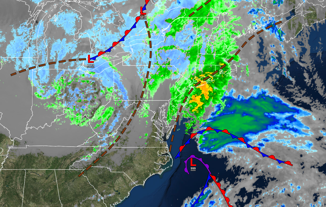
A developing coastal storm will produce strong winds and heavy rainfall along the coast and significant snow over the interior. A dry but chilly weather pattern is expected thereafter.
TONIGHT
The low-pressure system will track through the coastal waters with waves of rainfall along the coast while a wintry mix of snow, sleet, and rain will continue over the interior. The wintry mix will change over to all snow over the interior while snow will begin to mix in along the coast. Winds will back from the northeast to the northwest at 10 to 20 mph with gusts over 40 mph. Temperatures will fall into the upper 20s to lower 30s over the interior and mid to upper 30s along the coast for lows.
TOMORROW
The low-pressure system will slowly exit the region with periods of snow, heavy at times from Connecticut through the Hudson River Valley into the Poconos, a wintry mix of snow, sleet, and rain from Long Island through the northern suburbs of New York City and northern suburbs of Philadelphia, and periods of rain and snow showers throughout the New York City metropolitan and Philadelphia metropolitan areas. Winds will back to the northwest at 15 to 30 mph with gusts over 45 mph. Temperatures will rise into the upper 20s to lower 30s over the interior, mid to upper 30s in the New York City metropolitan area, and upper 30s to lower 40s in the Philadelphia metropolitan area for highs.
TOMORROW NIGHT
The low-pressure system will exit with overcast skies and lingering rain and snow showers through midnight followed by clearing skies towards morning. Winds will be from the northwest at 15 to 30 mph with gusts over 40 mph at times. Temperatures will fall into the mid to upper 20s over the interior and lower to mid-30s along the coast for lows.
WEDNESDAY
High pressure will produce clear skies to scattered clouds. Winds will be from the northwest at 10 to 20 mph with gusts up to 30 mph. Temperatures will rise into the mid to upper 30s over the interior, lower to mid-40s around the New York City metropolitan area, and mid to upper 40s in the Philadelphia metropolitan area for highs.
THURSDAY
High pressure will produce clear skies to scattered clouds. Winds will be from the northwest at 5 to 15 mph. Temperatures will range from the single digits to mid-10s for higher elevations, upper 10s to mid-20s over the interior, and upper 20s to lower 30s along the coast for lows and mid to upper 40s over the interior and lower to mid-50s along the coast for highs.
FRIDAY
High pressure will produce clear skies to scattered clouds. Winds will be from the southwest at 5 to 15 mph. Temperatures will range from the mid-30s to the lower 40s for lows and mid-40s to lower 50s over the interior, lower to mid-50s along the coast, and mid-50s to lower 60s in the Delaware River Valley for highs.
SATURDAY
A cold front will pass through the region with scattered showers. Temperatures will range from the mid to upper 30s over the interior and lower to mid-40s along the coast for lows and upper 40s to lower 50s over the interior and lower to mid-50s along the coast for highs.
SUNDAY
High pressure will produce scattered clouds. Temperatures will range from the lower to mid-20s over the interior and upper 20s to mid-30s along the coast for lows and lower to mid-30s over the interior and upper 30s to lower 40s along the coast for highs.
MONDAY
High pressure will produce scattered clouds. Temperatures will range from the upper 10s to lower 20s over the interior and lower to mid-20s along the coast for lows and mid to upper 40s over the interior and upper 40s to lower 50s along the coast for highs.
TUESDAY
High pressure will produce scattered clouds. Temperatures will range from the mid to upper 20s over the interior and upper 20s to lower 30s along the coast for lows and mid to upper 40s over the interior and along the coast and lower to mid-50s in the Delaware River Valley for highs.


