

 Warmer observations this morning have caused me to reevaluate the expected impacts of the snow and ice accumulation this evening.
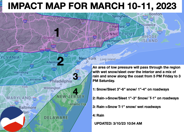
Clouds will continue to increase this morning while precipitation in the form of snow is starting to fall in central Pennsylvania. The precipitation will continue to slowly spread east and will be in place over much of the region by 5 PM. Periods of snow and sleet are expected in zone 1 this afternoon through tomorrow morning. Meanwhile, a mix of snow and rain can be expected in zones 2 and 3, gradually mixing over to snow overnight from northwest to southeast. Snow accumulation will be limited to cold surfaces for most locations. In zone 4 only rainfall is expected.
Please follow and like us:


