

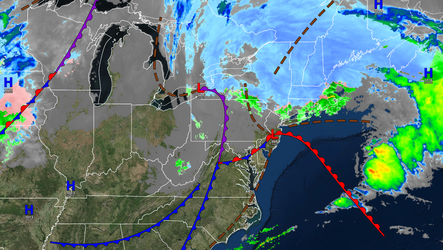
A significant storm that produced heavy rain along the coast and an icy wintry over the interior will exit the region today. More tranquil conditions take hold for the rest of the weekend.
TODAY
The low-pressure system will exit the region with periods of rain on the coast followed by clearing skies. Winds will be from the west at 10 to 20 mph with gusts over 30 mph at times. Temperatures will rise into the mid to upper 40s over the interior and upper 40s to lower 50s along the coast for highs.
TONIGHT
High pressure will build into the region with scattered clouds. Winds will be from the northwest at 5 to 15 mph. Temperatures will fall into the upper 20s to lower 30s for lows.
TOMORROW
High pressure will produce scattered clouds. Winds will be from the northwest at 5 to 15 mph. Temperatures will rise into the mid to upper 40s over the interior, mid-40s to lower 50s in the New York City metropolitan area, and lower to mid-50s in the Philadelphia metropolitan area for highs.
TOMORROW NIGHT
High pressure will produce scattered clouds. Winds will be from the northwest at 5 to 15 mph. Temperatures will fall into the mid to upper 20s over the interior and upper 20s to lower 30s along the coast for lows.
MONDAY
High pressure will produce scattered clouds. Winds will be from the northwest at 5 to 15 mph. Temperatures will rise into the mid to upper 40s over the interior, upper 40s to lower 50s along the coast, and lower to mid-50s in the Delaware River Valley for highs.
TUESDAY
A cold front will produce widely scattered showers. Winds will be from the northwest at 10 to 20 mph. Temperatures will range from the mid to upper 30s for lows and mid to upper 40s over the interior and lower to mid-50s along the coast for highs.
WEDNESDAY
High pressure will produce clear skies to scattered clouds. Temperatures will range from the upper 20s to lower 30s for lows and mid-30s to lower 40s over the interior and mid to upper 40s along the coast for highs.
THURSDAY
High pressure will produce scattered clouds. Temperatures will range from the lower to mid-20s over the interior and upper 20s to lower 30s along the coast for lows and lower to mid-40s for highs.
FRIDAY
High pressure will produce scattered clouds. Temperatures will range from the lower to mid-30s over the interior and upper 30s to lower 30s along the coast for lows and lower to mid-40s over the interior and mid-40s to lower 50s for highs.
SATURDAY
High pressure will exit the region with increasing clouds. A wintry mix of snow, sleet, and rain will develop late in the evening. Temperatures will range from the lower to mid-10s in the higher elevation, upper 10s to mid-20s over the interior, and upper 20s to lower 30s along the coast for lows and upper 30s to lower 40s over the interior and lower to mid-40s along the coast for highs.


