

A developing coastal storm will bring rainfall to parts of the Jersey shore. A mild weather pattern is on the way for the rest of the week.
TONIGHT
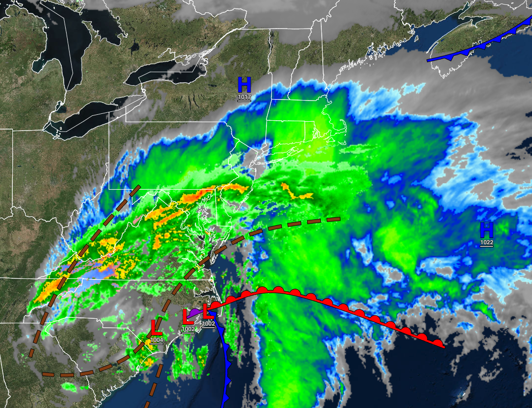
An area of low pressure will produce periods of rain along the New Jersey coast, scattered showers in the Philadelphia and New York City metropolitan areas, and scattered clouds further north and west. Winds will be from the northeast at 5 to 15 mph. Temperatures will fall into the mid-20s to the lower 30s over the interior and mid to upper 30s along the coast for lows.
TOMORROW
The area of low pressure will exit with showers in the morning followed by clearing skies. Winds will back to the northwest at 5 to 15 mph. Temperatures will rise into the upper 40s to lower 50s over the interior and lower to mid-50s along the coast for highs.
TOMORROW NIGHT
A weak trough will produce scattered clouds. Winds will be from the northwest at 5 to 15 mph. Temperatures will fall into the lower to mid-30s over the interior and mid to upper 30s along the coast for lows.
TUESDAY
High pressure will take hold with scattered cloud cover expected. Winds will back from the northwest to the southwest at 5 to 15 mph. Temperatures will rise into the mid to upper 40s over the interior and upper 40s to lower 50s along the coast for highs.
WEDNESDAY
A weak trough will pass through the region with scattered clouds and isolated showers. Winds will be from the southwest at 5 to 15 mph. Temperatures will range from the mid to upper 30s over the interior and upper 30s to lower 40s along the coast for lows and lower to mid-50s along the coast, mid to upper 50s over the interior, and upper 50s to lower 60s in the Delaware River Valley for highs.
THURSDAY
A warm front will lift through the region with periods of showers. Winds will be from the southwest at 5 to 15 mph. Temperatures will range from the lower to mid-40s over the interior and mid to upper 40s along the coast for lows and upper 50s to lower 60s for highs.
FRIDAY
A cold front will follow with scattered showers and a few isolated thunderstorms. Temperatures will range from the mid to upper 40s over the interior and lower to mid-50s along the coast for lows and mid to upper 50s over the interior and upper 50s to lower 60s along the coast for highs.
SATURDAY
High pressure will produce scattered clouds. Temperatures will range from the upper 10s to mid-20s for lows and upper 30s to mid-40s for highs.
SUNDAY
High pressure will produce scattered clouds. Temperatures will range from the upper 20s to mid-30s for lows and mid to upper 40s for highs.
MONDAY
High pressure will produce scattered clouds. Temperatures will range from the mid-30s to lower 40s for lows and lower to mid-50s for highs.


