

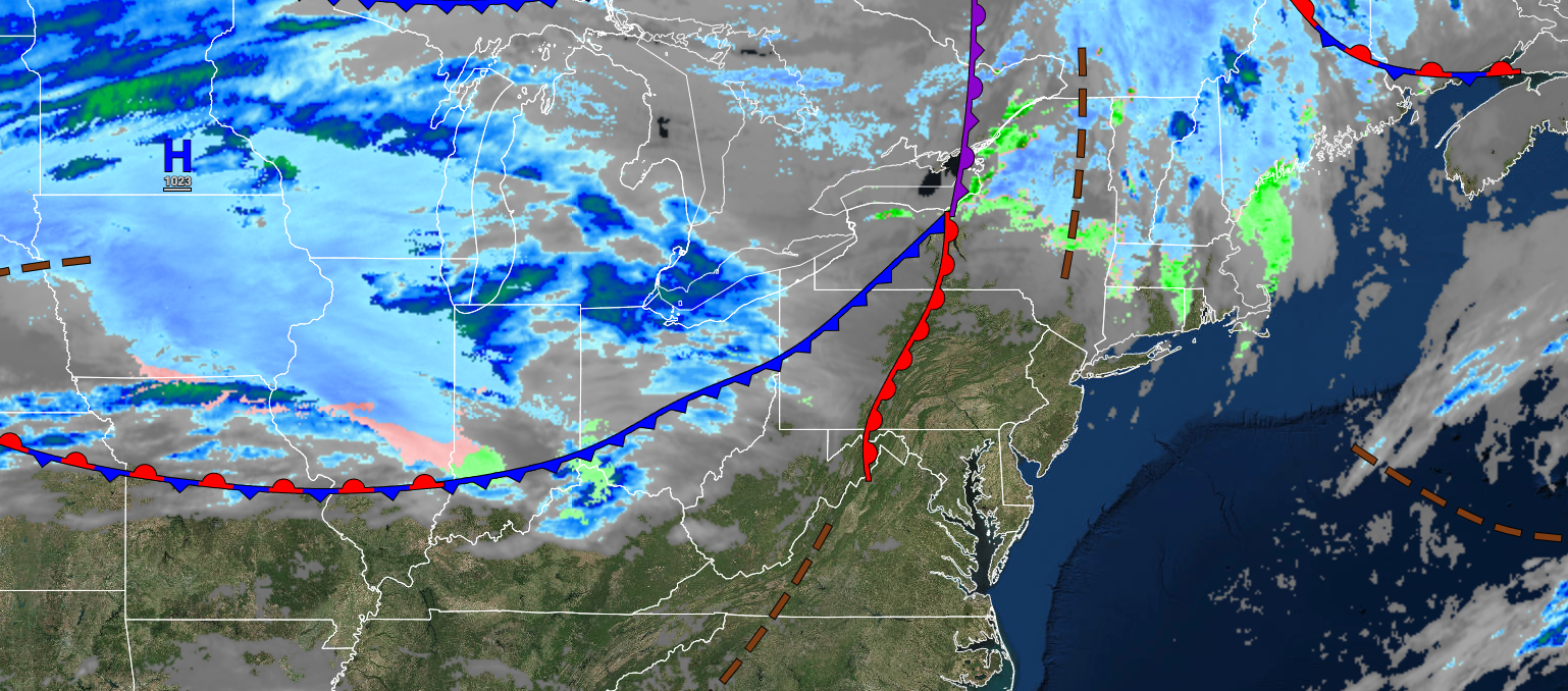
A few cold fronts will produce broken clouds and a few pesky showers through the weekend. A colder and more active weather pattern will be in place through next week.
TODAY
A trough will produce scattered clouds and isolated showers. Winds will be from the west at 5 to 15 mph. Temperatures will rise into the upper 30s to lower 40s over the interior and mid to upper 40s along the coast for highs.
TONIGHT
Scattered clouds are expected with winds from the west-southwest at 5 to 15 mph. Temperatures will fall into the lower to mid-30s for lows.
TOMORROW
A cold front will move through the region with scattered clouds and scattered showers in the afternoon and evening. Winds will be from the southwest at 5 to 15 mph. Temperatures will rise into the upper 40s to lower 50s along the coast for highs.
TOMORROW NIGHT
A stalling cold front will produce broken clouds and isolated showers. Winds will be from the northwest at 5 to 10 mph. Temperatures will fall into the lower to mid-30s for lows.
MONDAY
A stationary front will produce overcast skies with isolated showers towards evening. Winds will back to the northeast at 5 to 15 mph. Temperatures will rise into the upper 30s to lower 40s over the interior and lower to mid-40s along the coast for highs.
TUESDAY
A cold front will sink through the region with scattered rain and snow showers. Winds will be from the northwest at 5 to 15 mph. Temperatures will range from the mid to upper 20s over the interior and lower to mid-30s along the coast for lows and lower to mid-30s over the interior and upper 30s to mid-40s along the coast for highs.
WEDNESDAY
A stationary front with waves of low pressure will produce periods of snow, sleet, and rain. Temperatures will range from the upper 10s to the lower 20s over the interior and mid-20s to lower 30s along the coast for lows and mid to upper 20s over the interior, lower to mid-30s in the New York City metropolitan area, and mid to upper 30s in the Philadelphia metropolitan area and southern New Jersey for highs.
THURSDAY
A stationary front with waves of low pressure will produce scattered snow showers. Temperatures will range from the single digits to mid-10s over the interior, upper 10s to mid-20s in the suburbs, and upper 20s to lower 30s along the coast for lows and mid to upper 20s in the interior, lower to mid-30s in the I-95 corridor, and mid to upper 30s in southern New Jersey for highs.
FRIDAY
An area of low pressure will approach the region with increasing clouds and developing snow showers. Temperatures will range from the lower to mid-10s over the interior and upper 10s to mid-20s along the coast for lows and lower to mid-20s over the interior and upper 20s to lower 30s along the coast for highs.
SATURDAY
A series of weak troughs will produce scattered clouds and a few flurries. Temperatures will range from the single digits below zero to lower 10s over the interior and lower to mid-10s along the coast for lows and lower to mid-20s over the interior and mid to upper 20s along the coast for highs.


