

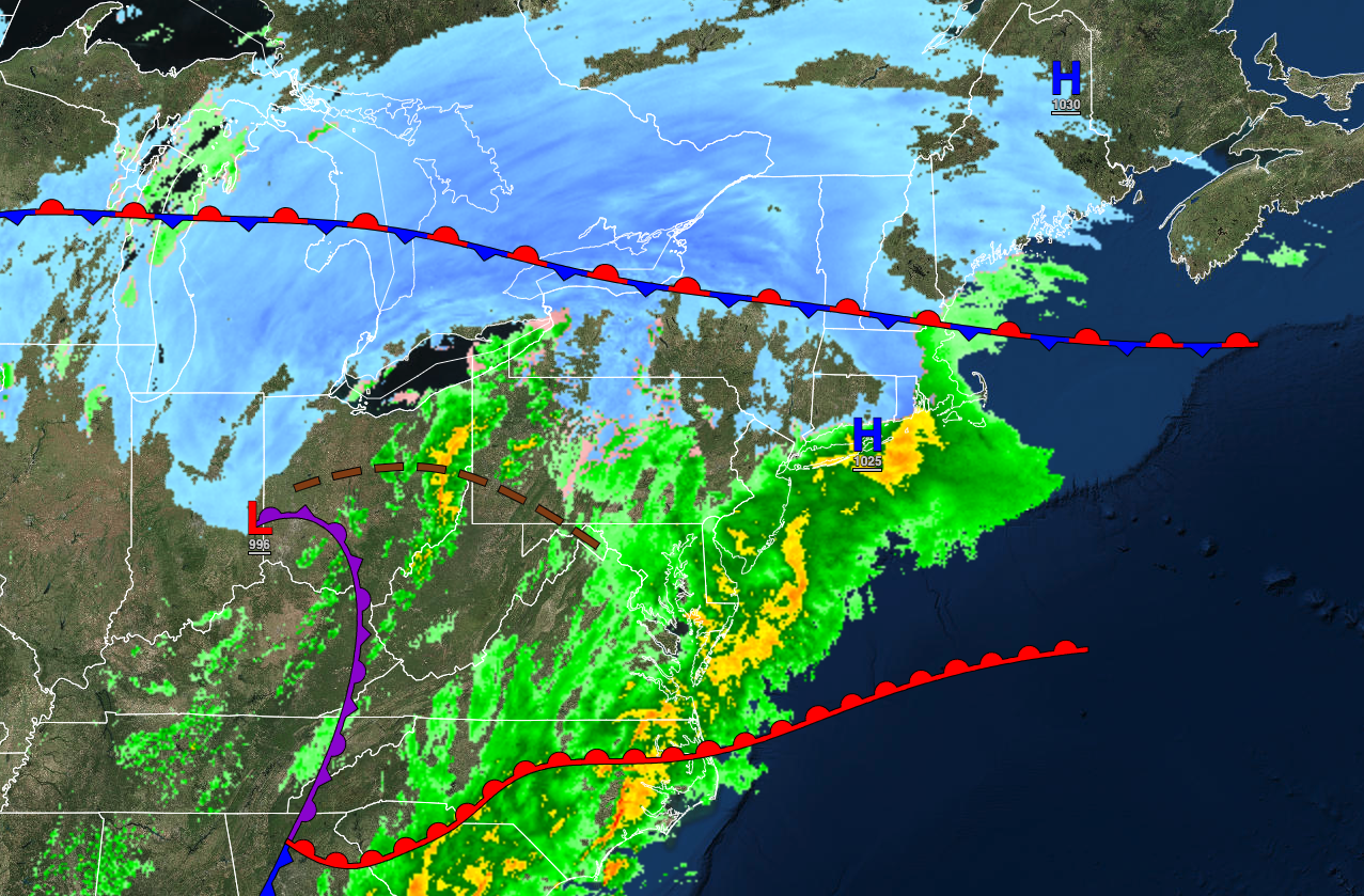
Waves of heavy rain will continue through tonight as a low-pressure system lifts through the region. Unsettled conditions are expected through next week.
TONIGHT
An area of low pressure and a warm front will produce periods of rain, heavy at times. Winds will be from the southeast at 5 to 15 mph. Temperatures will hold in the lower to mid-30s over the interior and upper 30s to mid-40s along the coast for lows.
TOMORROW
A series of troughs will produce scattered clouds and flurries. Winds will be from the west at 10 to 20 mph. Temperatures will fall through the 40s and 30s throughout the day.
TOMORROW NIGHT
High pressure will produce clearing skies. Winds will be from the northwest at 5 to 15 mph. Temperatures will fall into the upper 10s to mid-20s over the interior and upper 20s to lower 30s along the coast for lows.
FRIDAY
High pressure will produce clear skies to scattered clouds. Winds will be from the west at 5 to 15 mph. Temperatures will rise into the lower to mid-30s over the interior and upper 30s to lower 40s along the coast for highs.
SATURDAY
A trough will produce scattered clouds. Winds will be from the west at 5 to 15 mph. Temperatures will range from the mid to upper 20s over the interior and lower to mid-30s along the coast for lows and upper 30s to lower 40s over the interior and mid to upper 40s along the coast for highs.
SUNDAY
A cold front will move through the region with scattered clouds and scattered showers in the afternoon and evening. Winds will be from the southwest at 5 to 15 mph. Temperatures will range from the lower to mid-30s for lows and upper 30s to mid-40s over the interior and upper 40s to lower 50s along the coast for highs.
MONDAY
A stationary front will produce overcast skies with isolated showers towards evening. Temperatures will range from the lower to mid-30s over the interior and upper 30s to lower 40s along the coast for lows and upper 30s to lower 40s over the interior and mid-40s to lower 50s along the coast for highs.
TUESDAY
A stationary front will continue to waver over the region with overcast skies and scattered rain and snow showers. Temperatures will range from the lower to mid-30s over the interior and mid to upper 30s along the coast for lows and lower to mid-40s over the interior and upper 40s to lower 50s along the coast for highs.
WEDNESDAY
A stationary front will waver over the region with overcast skies and scattered rain and snow showers. Temperatures will range from the lower to mid-30s over the interior and upper 30s to lower 40s along the coast for lows and lower to mid-50s over the interior and mid-50s to lower 60s along the coast for highs.
THURSDAY
A stationary front with waves of low pressure will produce periods of rain and snow. Temperatures will range from the mid to upper 20s over the interior and lower to mid-30s along the coast for lows and lower to mid-30s over the interior and upper 30s to lower 40s along the coast for highs.


