

Arctic air is leaving with a few flurries and warmer conditions on the way. Above-normal temperatures are expected by the New Year.
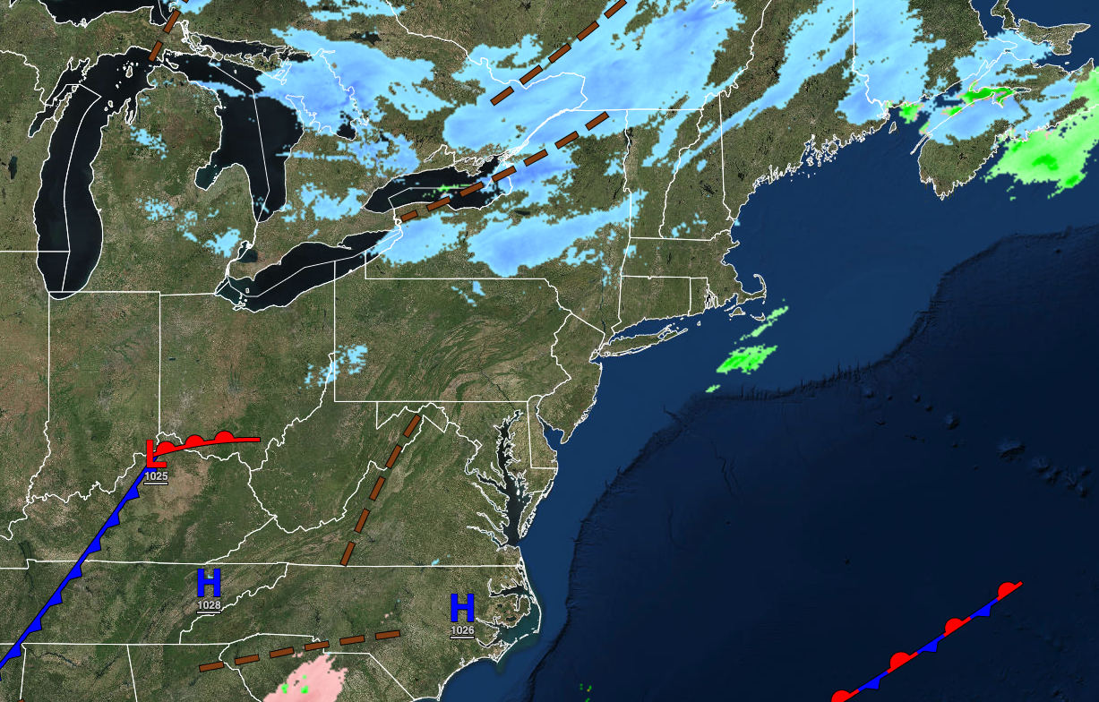
TODAY
A series of troughs will pass through the region with scattered clouds and flurries. Winds will be from the west at 5 to 15 mph. Temperatures will rise into the upper 20s to lower 20s over the interior and lower to mid-30s along the coast for highs.
TONIGHT
A series of troughs will pass through the region with scattered clouds and flurries. Winds will be from the west at 5 to 15 mph. Temperatures will fall into the lower to mid-20s for lows.
TOMORROW
An area of low pressure will produce scattered clouds and a few flurries. Winds will be from the southwest at 5 to 15 mph. Temperatures will rise into the upper 30s to lower 40s over the interior and lower to mid-40s along the coast for highs.
TOMORROW NIGHT
High pressure will produce clear skies to scattered clouds. Winds will be from the southwest at 5 to 15 mph. Temperatures will fall into the mid to upper 20s over the interior and lower to mid-30s along the coast for lows.
THURSDAY
High pressure will produce scattered clouds. Winds will be from the southwest at 5 to 15 mph. Temperatures will rise into the lower to mid-40s for highs.
FRIDAY
High pressure will produce scattered clouds. Temperatures will range from the lower to mid-30s for lows and mid-40s to lower 50s for highs.
NEW YEAR’S EVE
A cold front will approach with increasing clouds and scattered showers. Temperatures will range from the upper 30s to lower 40s over the interior and lower to mid-40s along the coast for lows and upper 40s to mid-50s for highs.
NEW YEAR’S
A cold front will produce periods of showers. Temperatures will range from the lower to mid-40s over the interior and upper 40s to lower 50s along the coast for lows and upper 40s to lower 50s over the interior and mid-50s to lower 60s along the coast for highs.
MONDAY
High pressure will produce clear skies to scattered clouds. Temperatures will range from the lower to mid-30s over the interior and upper 30s to lower 40s along the coast for lows and lower to mid-40s over the interior and upper 40s to lower 50s along the coast for highs.
TUESDAY
An area of low pressure will produce periods of showers. Temperatures will range from the lower to mid-40s for lows and lower to mid-50s over the interior and mid-50s to lower 60s along the coast for highs.


