

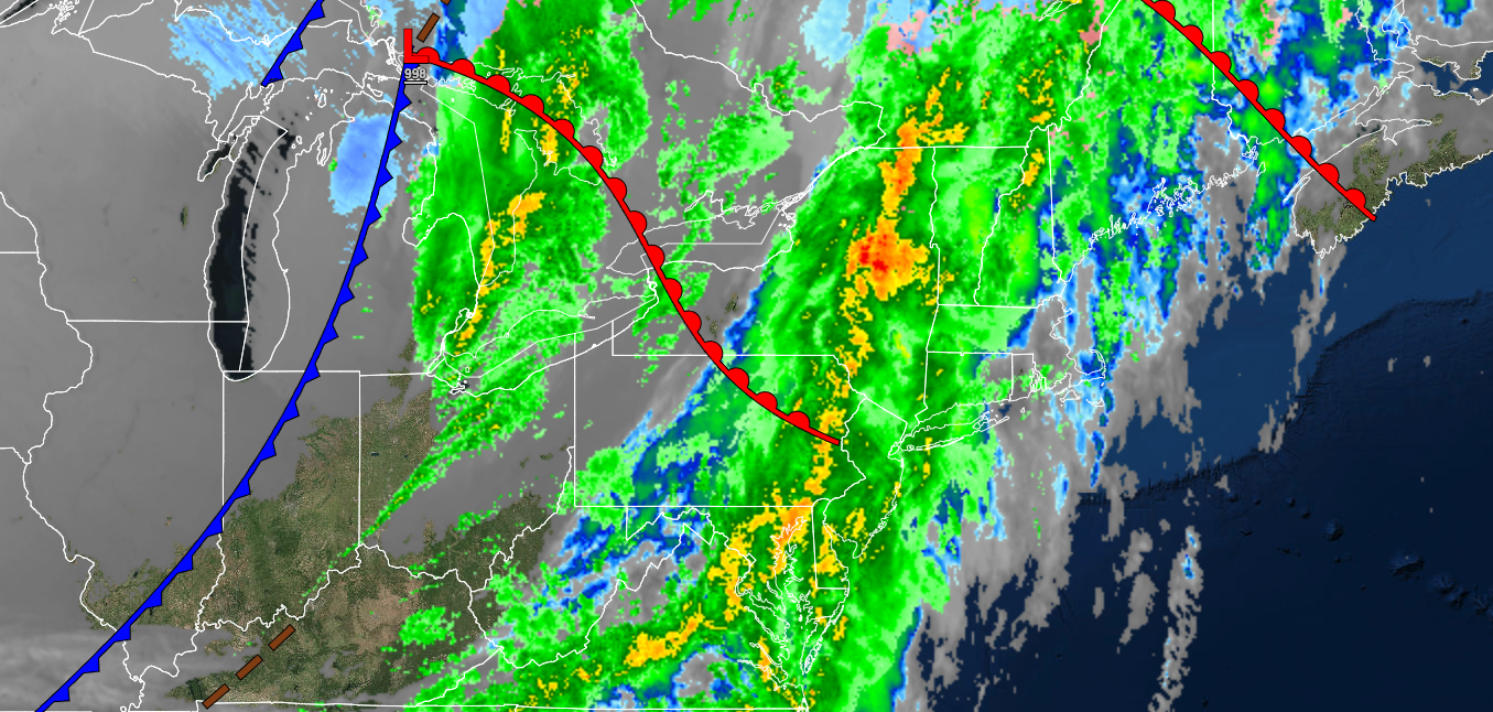
A strong cold front will produce periods of rain and windy conditions today. The gradual step down to a colder weather pattern continues with a volatile weather pattern.
TODAY
A strong cold front will produce periods of rain, heavy at times, through the afternoon. Winds will be from the southwest at 10 to 20 mph with gusts over 25 mph at times. Temperatures will rise into the lower to mid-50s over the interior and mid to upper 50s along the coast for highs.
TONIGHT
High pressure will build into the region with clearing skies. Winds will be from the northwest at 5 to 15 mph. Temperatures will fall into the mid to upper 20s over the interior and lower to mid-30s along the coast for lows.
TOMORROW
High pressure will produce clear skies to scattered clouds. Winds will be light and variable. Temperatures will rise into the mid to upper 30s over the interior and lower to mid-40s along the coast for highs.
TOMORROW NIGHT
High pressure will exit the region with increasing clouds. Winds will be from the southwest at 5 to 15 mph. Temperatures will fall into the lower to mid-20s over the interior and mid to upper 20s along the coast for lows.
MONDAY
Clouds will continue to increase. Winds will be from the south at 5 to 15 mph. Temperatures will rise into the lower to mid-40s over the interior and upper 40s to lower 50s along the coast for highs.
TUESDAY
A warm front will lift through the region with periods of rain. Winds will be from the south at 10 to 20 mph. Temperatures will range from the lower to mid-40s over the interior and upper 40s to lower 50s along the coast for lows and mid to upper 40s over the interior and lower to mid-50s along the coast for highs.
WEDNESDAY
A cold front will produce scattered showers. Temperatures will range from the lower to mid-40s over the interior and upper 40s to mid-50s along the coast for lows and upper 40s to lower 50s over the interior and mid to upper 50s along the coast for highs.
THURSDAY
High pressure will produce clear skies to scattered clouds. Temperatures will range from the upper 30s to lower 40s over the interior and mid to upper 40s along the coast for lows and lower to mid-40s over the interior and upper 40s to lower 50s along the coast for highs.
FRIDAY
High pressure will produce clear skies to scattered clouds. Temperatures will range from the upper 20s to the lower 30s over the interior and lower to mid-30s along the coast for lows and upper 30s to lower 40s for highs.
SATURDAY
High pressure will produce clear skies to scattered clouds. Temperatures will range from the lower to mid-20s over the interior and upper 20s to lower 30s along the coast for lows and upper 30s to lower 40s for highs.


