

Seventy-two years ago a post-Thanksgiving, and a most unusual, storm system moved up through the eastern U.S. The storm track took a bizarre turn to the northwest and it wreaked havoc on many locations and in a myriad of forms. Temperatures became mild from New England to Michigan while bitterly cold air swept into the Southeast. Storm surges that matched those from hurricanes battered the East Coast and wind gusts to 100 mph were recorded. A featured college football game was played in blizzard-like conditions.
A long time ago I gave this event the name “Backward” Storm. With topsy-turvy temperatures, it could be called the “Upside Down” Storm but it’s commonly referred to as the “Great Appalachian Storm”.
You would think that a group of bored meteorologists whipped up this fantasy scenario during a midnight shift. Amazingly enough, this storm actually occurred and it’s one that has intrigued me (and many other meteorologists) over and over again.
This is a storm that I didn’t experience because it occurred before I was born. Nothing about it was “conventional”. When all was said and done, this beast resulted in over 380 deaths and produced over 700 million (2022 dollars) in damage.
What made matters worse was that the peak of the storm, which extended from the Great Lakes and lower Midwest to the East Coast occurred during the two days following Thanksgiving, which created travel nightmares. Remember, this was before the Interstate Highway system was constructed. The ferocious winds led to hundreds of airline cancellations at major East Coast hubs. All told, over 1 million customers were left without power.
Storm History
An area of pressure formed near a frontal boundary in North Carolina. The upper-level atmospheric pattern featured a strong block. A prominent ridge of high pressure (bulge in the jet stream) aloft was situated over the western U.S. At the same time, another strong upper-level ridge set up over the western Atlantic and extended all the way up to Greenland.
A deep trough of low pressure (dip in the jet stream) set up from the Great Lakes to the Appalachians. Any surface weather system in the vicinity of the trough was blocked from moving eastward. As the Atlantic ridge continued to build westward, it forced the Carolina low-pressure system to “retrograde” slowly to the northwest. It eventually tracked up to West Virginia before stalling over Ohio and then moved slowly to southeastern Michigan and into southern Canada before dissipating.
Strong winds aloft rotating around the base of the upper-level trough allowed the storm to rapidly strengthen. By November 25th, its pressure was down to around 985 millibars. With a strong area of high pressure at the surface over Maine (1035 millibars) an extreme pressure gradient (difference in surface pressure) triggered very strong winds.
Track of the “Great Appalachian Storm” November 24-30, 1950.
Wind
The storm produced some eye-popping wind gusts over a large area. There was extensive wind damage from New England to the Appalachians. For example, Over one million customers in Upstate New York state lost power. Wind damage subsequently extended from the Appalachians westward.
Newark, New Jersey, reported a wind gust of 108 mph. Hartford, Connecticut gusted to 100 mph and a gust of 94 mph was recorded in New York City. An 80 mph gust occurred in Boston. At the top of Mt, Washington in New Hampshire, a wind gust to 160 mph was recorded. Winds blew off roofs at the University of Connecticut. Along the Connecticut coast, so much beach sand was blown onto the roads that plows had to remove it!
Here are comments from meteorologists from the U.S. Weather Bureau in Connecticut.
Hartford- “Of paramount interest in this month’s weather is the occurrence of “The Great Wind Storm of November 25, 1950″. Considering its great extent, extreme weather of various types, and its unusual meteorological character, this storm will be long remembered.
New Haven – “Severe southeast storm on 25th. Extensive wind and water damage to shore fronts. Many trees, wires, antennae down, and roofs are damaged.

This photo shows a storm surge battering the coastal area of Southport, Connecticut on November 25, 1950. Credit- Pequot Library.
To the west, winds gusted to 75 mph at Buffalo and Pittsburgh reported blizzard conditions with winds of over 50 mph as heavy snow was falling.
Rainfall
Milder air around the East Coast kept precipitation in the form of rain. A general area of two to six inches of rain fell from Virginia to New England.
Storm surge
With a persistent southeasterly wind, the storm surge was significant, especially at times of high tide from the Mid-Atlantic to New England. At LaGuardia Airport in New York, water crashed through dikes that had been set up and inundated runways which led to major delays and flight cancellations!

This photo shows water inundating runways at LaGuardia Airport in New York on November 25, 1950, creating major travel disruptions.
The storm surge flooded large portions of New York City including the lower east side of Manhattan. Tidal surges along the Connecticut coast were nearly 8 feet as strong southeast winds were relentless.
Snowfall
The heaviest snow from the storm occurred from western Pennsylvania down to West Virginia.
There were also some impressive amounts of snow in Ohio and Kentucky, as well. Coburn Creek, West Virginia, recorded 62 inches of snow. Over 30 inches of snow buried Pittsburgh, while Cleveland had to deal with nearly 2 feet of snow and drifts 4 to 5 feet high!
Heavy snow and below-zero wind chills in Columbus Ohio didn’t scare spectators away from the annual football game between Michigan and Ohio State. The winner of this game would be invited to the Rose Bowl. The game itself, one that would not be played today, was given the name “Snow Bowl”.
The temperature was 10 degrees with northwest winds gusting to 28 mph. Snow was falling at a rate of 2 inches per hour. As for the game itself, there were an astounding 45 punts as BOTH teams often punted on first down. Michigan won that game 9-3 without making even one first down but Ohio State star Vic Janowicz actually kicked a 38-yard field goal in the wind and snow with the goal posts barely visible.

This photo shows the University of Michigan kicker Harry Allis kicking an extra point during the famous “Snow Bowl” football game on November 25, 1950. Credit -Wikimedia-Public Domain

The photo shows residents of Jamestown, Ohio as they trudge through more than 30 inches of snow on November 26, 1950. Credit-James Sutton-Public Domain.
In 2004, an impact scale for Northeast snowstorms was developed by Paul Kocin and Dr. Louis Ucellini. The scale ranks high impact storms that produced at least 10 inches of snow. In addition to snowfall, the scale includes population so the rating measures overall societal impacts of the event. NESIS, as it’s called, has five categories, Notable , Significant, Major, Crippling and Extreme. This storm was rated a “5” (Extreme) for the Ohio Valley which is the highest on record for that region!

This map shows total snowfall from the “Great Appalachian Storm” of 1950 and the NESIS rating for the Northeast and Ohio Valley. Credit-National Centers For Environmental Information.
Temperature
Perhaps the most extraordinary feature of this storm was temperature extremes and the fact that much of the Southeast U.S. was considerably colder than the Northeast. As mentioned earlier, the storm became very intense as it retrograded from the Carolinas to Ohio. Basically, the storm was wound up “like a top”.
As a result, frigid air was swept into the Deep South, while milder air persisted over New England, and a warm front actually moved westward across southern Canada and Upstate New York into Michigan!
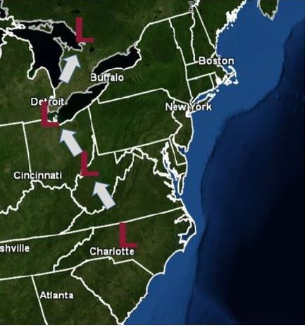
On November 25th, Pittsburgh was reporting a temperature of 9 degrees with heavy snow and at the same time, Buffalo was a balmy 54 degrees following a warm frontal passage. Detroit, Michigan also experienced a rapid temperature rise after a warm front passed through from the (EAST)!
 A meteorological chart for 850 millibars (around 5,000′) indicating extreme temperature contrasts (degrees Celcius) on November 25, 1950. Credit- Richard Grumm- NWS.
At the same time, temperatures shockingly plunged below zero in Atlanta, Georgia, and into the low 20s across northern Florida and coastal Alabama. Birmingham, Alabama plunged to 5 degrees, and Jacksonville, Florida, shivered at 23 degrees. Savannah, Georgia recorded a shivering low of 17 degrees. Many November temperature records were obliterated across the Southeast.
While low-temperature records were being destroyed across the Southeast, low temperatures from the Mid-Atlantic to much of New England ranged from the upper 40s to low 50s on the morning of November 25th.
It could be a long time before we see a storm like this one again. Winter Weather Expert Paul Kocin, mentioned earlier, (who I worked with at The Weather Channel by the way) said that this storm “had the greatest contrast of weather elements in probably any storm, including the 1993 March “Superstorm!”

