

After the cold front exits, excellent weather return through the weekend. More rainfall returns next week.
TODAY
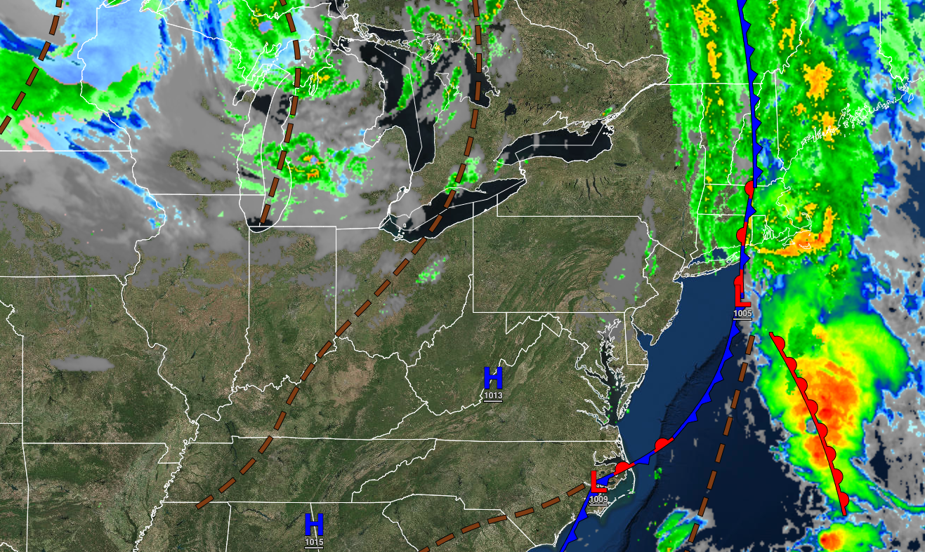
The cold front will clear the coast with showers exiting the region in Connecticut and eastern Long Island. Winds will be from the west at 5 to 15 mph. Temperatures will rise into the upper 50s to lower 60s in the interior and mid to upper 60s along the coast for highs.
TONIGHT
A trough will pass through the region with scattered clouds. Winds will be from the north-northwest at 5 to 10 mph. Temperatures will fall into the lower to mid-40s over the interior, mid to upper 40s in the suburbs, and upper 40s to lower 50s in the urban areas for lows.
TOMORROW
High pressure will produce clear skies to scattered clouds. Winds will be from the south at 5 to 15 mph. Temperatures will rise into the lower to mid-60s over the interior, mid to upper 60s along the coast, and upper 60s to lower 70s in the Delaware River Valley for highs.
TOMORROW NIGHT
High pressure will produce clear skies to scattered clouds. Winds will southwest at 5 to 10 mph. Temperatures will fall into the upper 30s to mid-40s over the interior, upper 40s to lower 50s in the suburbs, and lower to mid-50s in urban areas for lows.
SUNDAY
A weak trough will produce a few scattered clouds. Winds will be from the west at 5 to 15 mph. Temperatures will rise into the mid to upper 50s over the interior and lower to mid-60s along the coast for highs.
MONDAY
An area of low pressure will produce periods of showers as a warm front lifts through the region followed by a strong cold front. Winds will be from the southeast at 5 to 15 mph. Temperatures will range from the lower to mid-40s over the interior, upper 40s to lower 50s in the suburbs, and mid to upper 50s along the coast for lows and upper 40s to mid-50s over the interior and upper 50s to lower 60s along the coast for highs.
TUESDAY
An area of low pressure will exit the region with lingering scattered showers followed by clearing skies towards evening. Temperatures will range from the mid to upper 30s over the interior and lower to mid-40s along the coast for lows and mid to upper 40s over the interior and lower to mid-50s for highs.
WEDNESDAY
A series of troughs will produce scattered clouds and very isolated rain or snow showers in the Poconos and Catskills. Temperatures will range from the lower to mid-30s over the interior, mid to upper 30s in the suburbs, and upper 30s to lower 40s in urban areas for lows and mid to upper 40s over the interior and lower to mid-50s along the coast for highs.
THURSDAY
A series of troughs will produce scattered clouds and very isolated rain or snow showers in the Poconos and Catskills. Temperatures will range from the upper 20s to mid-30s over the interior and mid-30s to lower 40s along the coast for lows and mid to upper 40s over the interior and lower to mid-50s along the coast for highs.
FRIDAY
High pressure will produce clear skies to scattered clouds. Temperatures will range from the lower to mid-30s over the interior, upper 30s to mid-40s in the suburbs, and mid to upper 40s in urban areas for lows and lower to mid-50s over the interior and upper 50s to lower 60s along the coast for highs.


