

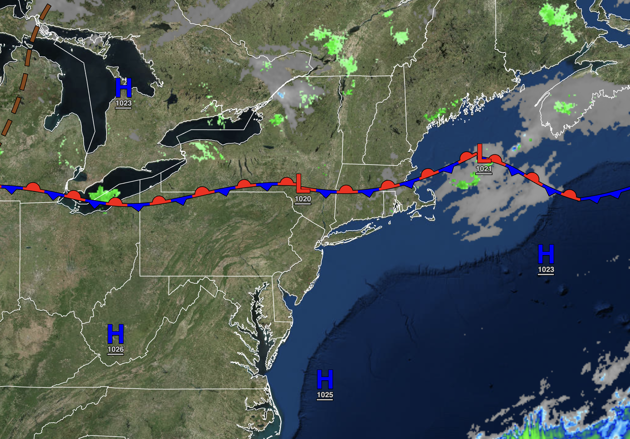
Tranquil conditions will continue through mid-week. A powerful cold front is expected on Thursday.
TONIGHT
High pressure will pass over the region with scattered clouds to clear skies. Winds will be from the southwest at 5 to 10 mph. Temperatures will fall into the upper 30s to lower 40s over the interior and mid to upper 40s along the coast for lows.
TOMORROW
High pressure will produce scattered clouds. Winds will be from the southwest at 5 to 15 mph. Temperatures will rise into the mid to upper 60s over the interior, mid to upper 60s along the coast, and upper 60s to lower 70s in the Delaware River Valley for highs.
TOMORROW NIGHT
High pressure will be off the coast with scattered clouds. Winds will be from the southwest at 5 to 10 mph. Temperatures will fall into the upper 40s to lower 50s for lows.
WEDNESDAY
High pressure will exit the region with increasing clouds. Winds will be from the southwest at 5 to 15 mph. Temperatures will rise into the mid to upper 60s along the coast, mid to upper 60s over the interior, and upper 60s to lower 70s in the Delaware River Valley for highs.
THURSDAY
A cold front will produce periods of rain, heavy at times, and embedded thunderstorms with windy conditions. Winds will be from the southwest at 5 to 15 mph with gusts over 20 mph at times. Temperatures will range from the mid to upper 50s over the interior and upper 50s to lower 60s along the coast for lows and lower to mid-60s over the interior and upper 60s to lower 70s along the coast for highs.
FRIDAY
The cold front will exit with a few lingering showers in the morning followed by clearing skies. Temperatures will range from the lower to mid-40s over the interior, upper 40s to lower 50s in the suburbs, and mid to upper 50s along the coast for lows and upper 50s to lower 60s over the interior and mid to upper 60s along the coast for highs.
SATURDAY
High pressure will produce scattered clouds. Temperatures will range from the lower to mid-40s over the interior and mid to upper 40s along the coast for lows and upper 50s to lower 60s over the interior and mid to upper 60s along the coast for highs.
SUNDAY
High pressure will produce clear skies with a few scattered clouds. Temperatures will range from the mid to upper 40s for lows and lower to mid-60s over the interior, mid to upper 60s along the coast, and upper 60s to lower 70s in the Delaware River Valley for highs.
MONDAY
An area of low pressure will approach with increasing clouds and scattered showers. Temperatures will range from the lower to mid-40s over the interior, upper 40s to lower 50s in the suburbs, and mid to upper 50s along the coast for lows and upper 40s to mid-50s over the interior and upper 50s to lower 60s along the coast for highs.
TUESDAY
An area of low pressure will pass through the region with periods of showers. Temperatures will range from the lower to mid-40s over the interior and upper 40s to lower 50s along the coast for lows and mid to upper 40s over the interior and lower to mid-50s along the coast for highs.


