

A classic Nor’Easter will start the first week of October, but tranquil conditions return soon.
TONIGHT
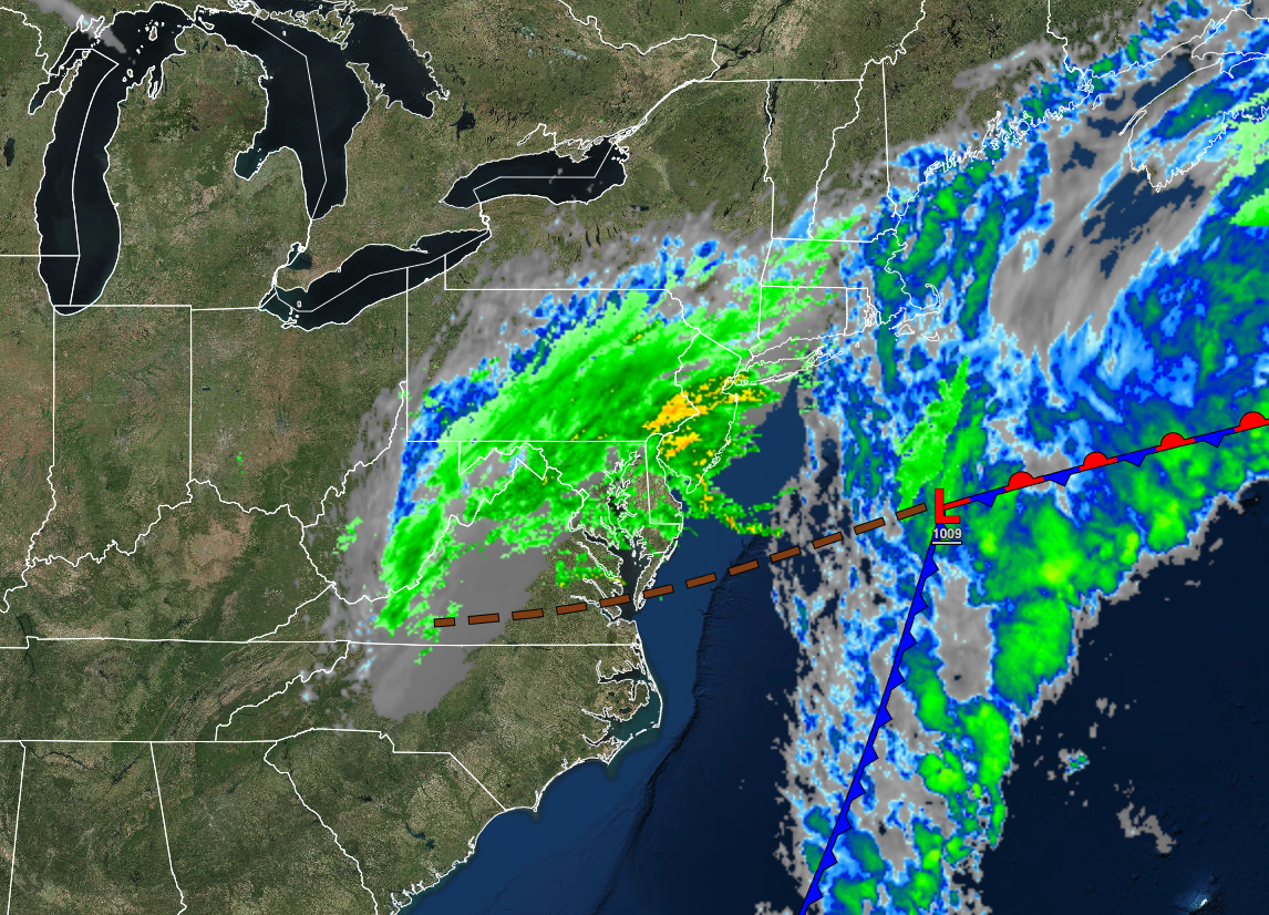
An area of low pressure will produce periods of rain, heavy at times. Winds will be from the northeast at 15 to 30 mph. Coastal flooding will be a threat, especially along the New Jersey coast. Temperatures will fall into the lower to mid-40s over the interior and mid to upper 40s along the coast for lows.
TOMORROW
An area of low pressure will produce periods of showers, heavy at times. Winds will be from the northeast at 15 to 30 mph. Coastal flooding will be a threat, especially along the New Jersey coast. Temperatures will rise into the lower to mid-50s over the interior and mid to upper 50s along the coast for highs.
TOMORROW NIGHT
An area of low pressure will produce periods of showers, heavy at times. Winds will be from the northeast at 15 to 30 mph. Coastal flooding will be a threat, especially along the New Jersey coast. Temperatures will fall into the mid to upper 40s for lows.
TUESDAY
A powerful coastal low-pressure system will linger off the coast with periods of rain, heavy at times. Winds will be from the northeast at 5 to 15 mph over the interior and 15 to 30 mph along the coast. Coastal flooding will be a threat, especially along the New Jersey coast. Temperatures will rise into the lower to mid-50s for highs.
WEDNESDAY
The low-pressure system will exit with scattered clouds and isolated showers. Winds will be from the north at 10 to 20 mph. Temperatures will range from the lower to mid-40s over the interior and upper 40s to mid-50s along the coast for lows and lower to mid-60s for highs.
THURSDAY
A cold front will pass through the region with scattered clouds and isolated showers. Temperatures will range from the upper 40s to lower 50s for lows and lower to mid-70s for highs.
FRIDAY
High pressure will produce clear skies. Temperatures will range from the lower to mid-50s over the interior and mid to upper 50s along the coast for lows and mid to upper 60s over the interior and lower to mid-70s along the coast for highs.
SATURDAY
High pressure will produce scattered clouds and clear skies. Temperatures will range from the upper 30s to lower 40s over the interior and mid to upper 40s along the coast for lows and upper 40s to lower 50s over the interior and mid to upper 50s along the coast for highs.
SUNDAY
High pressure will produce scattered clouds and clear skies. Temperatures will range from the mid to upper 30s over the interior and lower to mid-40s along the coast for lows and lower to mid-50s over the interior and upper 50s to lower 60s along the coast for highs.
MONDAY
High pressure will produce scattered clouds and clear skies. Temperatures will range from the upper 30s to lower 40s over the interior and lower to mid-40s along the coast for lows and upper 50s to lower 60s over the interior and lower to mid-60s along the coast for highs.


