

A series of cold fronts will produce unsettled conditions through mid-week. A powerful cold front is expected by Thursday morning.
TODAY
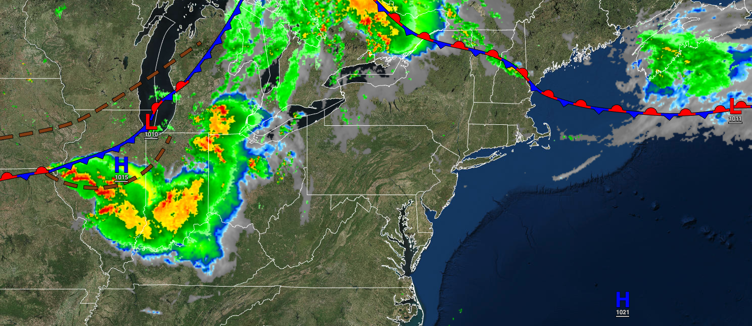
A stationary front will linger over the region with broken clouds and isolated showers and thunderstorms. Winds will be from the southwest at 5 to 15 mph. Temperatures will rise into the upper 70s to lower 80s over the interior and lower to mid-80s along the coast for highs.
TONIGHT
The stationary front will linger over the region with broken clouds and isolated showers. Winds will be from the southwest at 5 to 15 mph. Temperatures will fall into the upper 50s to lower 60s over the interior and lower to mid-60s along the coast for lows.
TOMORROW
The stationary front will linger over the region with broken clouds and isolated showers. Winds will be from the southwest at 5 to 15 mph. Temperatures will rise into the lower to mid-70s over the interior and upper 70s to lower 80s along the coast for highs.
TOMORROW NIGHT
The stationary front will linger over the region with broken clouds and isolated showers. Winds will be from the southwest at 5 to 15 mph. Temperatures will fall into the mid to upper 50s over the interior and upper 50s to lower 60s along the coast for lows.
WEDNESDAY
The stationary front will linger over the region with broken clouds and isolated showers. Winds will be from the west at 5 to 15 mph. Temperatures will rise into the mid to upper 70s over the interior, mid-70s to lower 80s along the coast, and lower to mid-80s in the Delaware River Valley for highs.
THURSDAY
A strong cold front will move through the region in the morning with showers and thunderstorms followed by clearing skies. Temperatures will range from the upper 50s to lower 60s over the interior and mid to upper 60s along the coast for lows and upper 60s to mid-70s for highs.
FRIDAY
High pressure will build into the region with clearing skies. Temperatures will range from the mid to upper 40s over the interior and lower to mid-50s along the coast for lows and upper 50s to lower 60s over the interior and lower to mid-60s along the coast for highs.
SATURDAY
High pressure will be in control, with clear skies to scattered clouds. Temperatures will range from the upper 30s to mid-40s over the interior and upper 40s to lower 50s along the coast for lows and mid to upper 60s over the interior and upper 60s to lower 70s along the coast for highs.
SUNDAY
High pressure will produce clear skies. Temperatures will range from the upper 40s to lower 50s over the interior and lower to mid-50s along the coast for lows and lower to mid-70s over the interior, lower to mid-70s along the coast, and upper 70s to lower 80s in the Delaware River Valley for highs.
MONDAY
A cold front will move through the region with scattered showers capable of heavy downpours. Temperatures will range from the upper 50s to lower 60s, lower to mid-60s in urban areas for lows, and upper 60s to lower 70s for highs.


