

Tranquil conditions take hold, but showers are expected to return by the end of the weekend.
TONIGHT
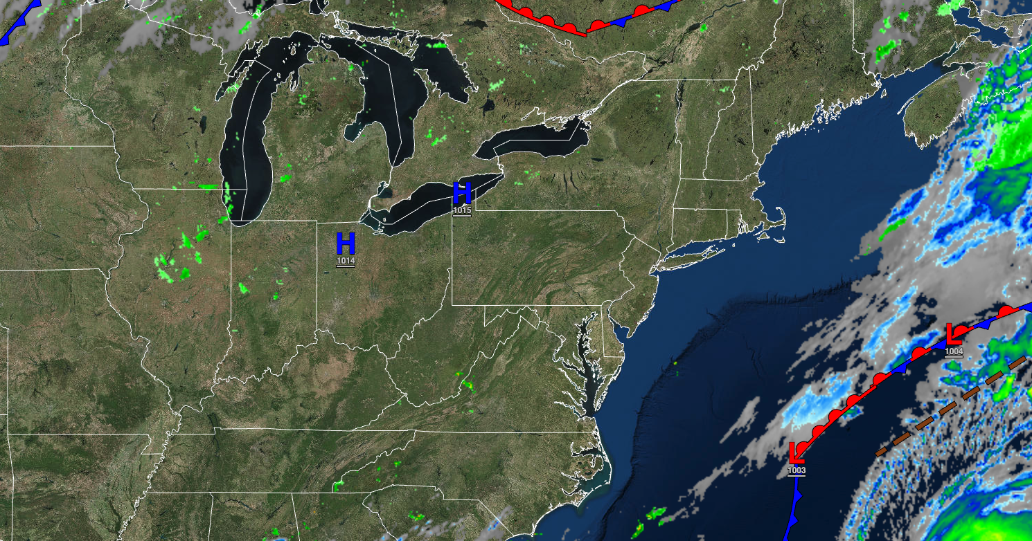
High pressure will produce clearing skies. Winds will be from the northeast at 5 to 15 mph. Temperatures will fall into the mid to upper 50s over the interior and upper 50s to lower 60s along the coast for lows.
TOMORROW
High pressure will produce clear skies with a few clouds. Winds will be from the northeast at 5 to 10 mph. Temperatures will rise into the upper 70s to lower 80s for highs.
TOMORROW NIGHT
High pressure will begin to exit the region with scattered cloud cover. Winds will be from the north at 5 to 10 mph. Temperatures will fall into the upper 50s to lower 60s for lows.
SATURDAY
High pressure will produce clear skies with a few clouds. Winds will be from the northwest at 5 to 10 mph. Temperatures will rise into the upper 70s to lower 80s for highs.
SUNDAY
By the afternoon, a warm front will approach the region with increasing clouds and scattered showers. Winds will back to the southeast at 5 to 15 mph. Temperatures will range from the mid-60s for lows and mid-60s to lower 70s over the interior, lower to mid-70s along the coast, and mid to upper 70s in the Delaware River Valley for highs.
MONDAY
A warm front will lift through the region with scattered showers. Temperatures will range from the mid to upper 60s for lows and mid-70s to lower 80s for highs.
TUESDAY
A cold front will follow, with scattered showers expected. Temperatures will range from the mid to upper 60s over the interior and upper 60s to lower 70s along the coast for lows and lower to mid-70s over the interior and upper 70s to lower 80s along the coast for highs.
WEDNESDAY
A trough will pass through the region with scattered clouds and isolated showers. Temperatures will range from the lower to mid-50s over the interior and upper 50s to mid-60s along the coast for lows and mid-70s to lower 80s for highs.
THURSDAY AND FRIDAY
High pressure will produce clear skies with scattered cloud cover. Temperatures will range from the mid to upper 50s over the interior and upper 50s to lower 60s along the coast for lows and mid-70s to lower 80s over the interior, lower to mid-80s along the coast, and mid to upper 80s in the Delaware River Valley for highs.


