

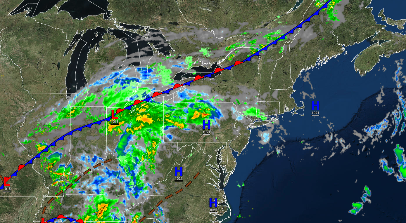
An approaching cold front will support increasing cloud cover and the threat of showers. Widespread rainfall returns by Tuesday.
TODAY
High pressure will exit with increasing clouds and isolated showers. Winds will be from the south at 5 to 15 mph. Temperatures will rise into the lower to mid-80s along the coast and mid to upper 80s away from the coast for highs.
TONIGHT
A cold front will approach with broken cloud cover and widely scattered showers. Winds will be from the southeast at 5 to 15 mph. Temperatures will fall into the mid to upper 60s over the interior and upper 60s to lower 70s for lows.
TOMORROW
A cold front will slowly press through the region with broken clouds and scattered showers. Winds will be from the southeast at 5 to 15 mph. Temperatures will rise into the lower to mid-70s over the interior, upper 70s to mid-80s along the coast, and mid to upper 80s in the Delaware River Valley for highs.
TOMORROW NIGHT
A stationary front will produce overcast cloud cover and scattered showers. Winds will back from the southeast to the northeast at 5 to 15 mph. Temperatures will fall into the mid to upper 60s over the interior and upper 60s to lower 70s along the coast for lows.
TUESDAY
An area of low pressure will produce periods of rain, heavy at times. Rainfall amounts of 1″ to 2″ will be possible. Winds will be from the northeast at 5 to 15 mph. Temperatures will rise into the upper 60s to lower 70s over the interior and lower to mid-70s along the coast for highs.
WEDNESDAY
The cold front will sink to the south with showers in the morning followed by broken clouds in the afternoon. Temperatures will range from the lower to mid-60s for lows and lower to mid-70s for highs.
THURSDAY
A trough will linger over the region with scattered clouds with isolated showers. Temperatures will range from the mid to upper 50s over the interior and lower to mid-60s along the coast for lows and mid to upper 70s for highs.
FRIDAY
High pressure will produce clear skies to scattered clouds. Temperatures will range from the mid to upper 50s over the interior and upper 50s to lower 60s along the coast for lows and mid to upper 70s over the interior and upper 70s to lower 80s along the coast for highs.
SATURDAY
High pressure will produce clear skies to scattered clouds. Temperatures will range from the mid to upper 50s over the interior and upper 50s to lower 60s along the coast for lows and mid to upper 70s over the interior, upper 70s to lower 80s along the coast, and lower to mid-80s in the Delaware River Valley for highs.
SUNDAY
A cold front will produce scattered showers. Temperatures will range from the mid to upper 60s over the interior and upper 60s to lower 70s along the coast for lows and mid to upper 70s over the interior and upper 70s to lower 80s along the coast for highs.


