

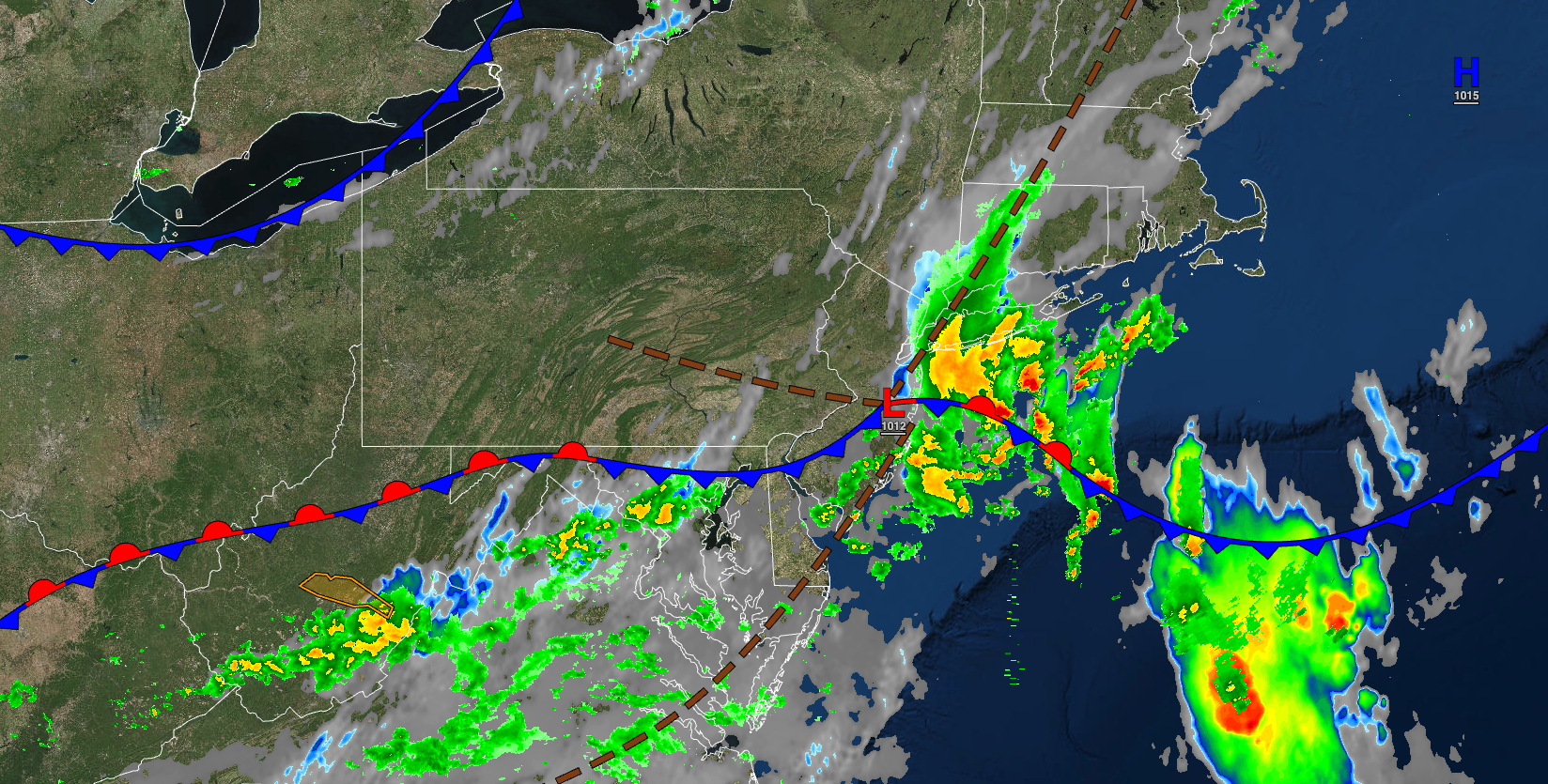
Showers and thunderstorms this morning signal the end of the hot and humid weather pattern, but an active weather pattern will take its place.
TODAY
The cold front will continue to drop south as a wave of low pressure moves through the region with scattered showers and thunderstorms. Otherwise, variable cloud cover can be expected. Winds will back to the northwest at 5 to 15 mph. Temperatures will rise into the mid to upper 80s for highs.
TONIGHT
A second cold front will follow with a few lingering isolated showers and scattered cloud cover. Winds will be from the northwest at 5 to 10 mph. Temperatures will fall into the upper 50s to lower 60s over the interior, mid to upper 60s in the suburbs, and upper 60s to lower 70s in urban areas for lows.
TOMORROW
A few isolated showers are possible in the morning followed by clearing skies. Winds will be from the north-northwest at 5 to 15 mph. Temperatures will rise into the mid to upper 70s over the interior and lower to mid-80s along the coast for highs.
TOMORROW NIGHT
High pressure will produce clear skies with scattered cloud cover. Winds will be from the north at 5 to 15 mph. Temperatures will fall into the lower to mid-50s over the higher elevations, upper 50s to mid-60s in the suburbs, and mid to upper 60s in urban areas for lows.
SATURDAY
A wave of low pressure over the coastal waters will produce scattered cloud cover. An isolated shower is possible but unlikely on the coast. Winds will be from the west at 5 to 15 mph. Temperatures will rise into the mid to upper 70s over the interior and along the coast and lower to mid-80s in the Delaware River Valley for highs.
SUNDAY
High pressure will produce clear skies to scattered clouds. Temperatures on Sunday will range from the mid to upper 50s over the interior and lower to mid-60s along the coast for lows and upper 70s to lower 80s over the interior and lower to mid-80s along the coast for highs.
MONDAY
A cold front with a wave of low pressure will produce scattered showers. Temperatures will range from the upper 50s to lower 60s over the interior and mid-60s along the coast for lows and mid to upper 70s over the interior and upper 70s to lower 80s along the coast for highs.
TUESDAY
A stalled frontal boundary will produce broken clouds and scattered showers. Temperatures will range from the mid to upper 50s over the interior and the lower to mid-60s along the coast for lows and upper 70s to lower 80s along the coast, lower to mid-80s over the interior, and mid to upper 80s in the Delaware River Valley for highs.
WEDNESDAY
A wave of low pressure along a stationary front will produce variable cloud cover and scattered showers. Temperatures will range from the upper 50s to lower 60s over the interior and mid to upper 60s along the coast for lows and upper 70s to lower 80s over the interior and along the coast and lower to mid-80s in the Delaware River Valley for highs.
THURSDAY
A weak cold front will produce widely scattered showers. Temperatures will range from the upper 50s to lower 60s over the interior and lower to mid-60s along the coast for lows and upper 70s to lower 80s over the interior and along the coast and lower to mid-80s in the Delaware River Valley for highs.


