

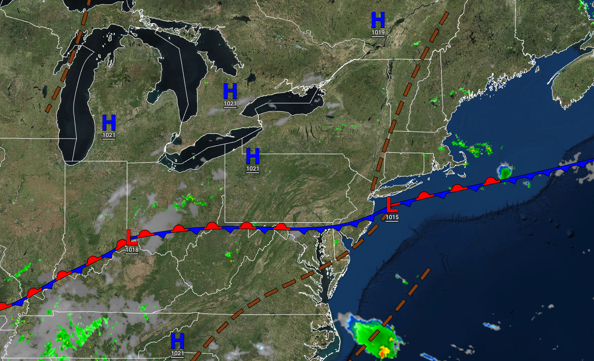
A cold front is putting an end to the brutal heat, but a few showers and thunderstorms will be the price to pay.
TODAY
A cold front will slowly approach the region with scattered showers and thunderstorms. Winds will veer from the southwest to the northwest at 5 to 15 mph. Temperatures will rise into the lower to mid-80s over the interior, mid to upper 80s along the coast, and upper 80s to lower 90s in the Delaware River Valley for highs.
TONIGHT
The cold front will slowly press south with scattered showers and thunderstorms. Winds will be from the northwest at 5 to 10 mph. Temperatures will fall into the lower to mid-60s over the interior, upper 60s to lower 70s in the suburbs, and lower to mid-70s in urban areas for lows.
TOMORROW
The cold front will press through the region with showers and thunderstorms. Winds will veer from the northwest to the north at 5 to 15 mph. Temperatures will rise into the lower to mid-80s over the interior and mid to upper 80s along the coast for highs.
TOMORROW NIGHT
Skies will clear as high pressure begins to build into the region. Winds will be from the north at 5 to 10 mph. Temperatures will fall into the upper 50s to mid-60s over the interior and upper 60s to lower 70s along the coast for lows.
FRIDAY
High pressure will build into the region with clearing skies. Winds will be from the north at 5 to 15 mph. Temperatures will rise into the mid to upper 70s over the interior and lower to mid-80s along the coast for highs.
SATURDAY AND SUNDAY
High pressure will produce clear skies to scattered clouds. Temperatures on Saturday will range from the lower to mid-50s over the interior and upper 50s to mid-60s along the coast for lows and mid to upper 70s over the interior and upper 70s to lower 80s along the coast for highs. Temperatures on Sunday will range from the mid to upper 50s over the interior and lower to mid-60s along the coast for lows and lower to mid-80s for highs.
MONDAY
A cold front will move through the region with isolated showers. Temperatures will range from the lower to mid-60s over the interior and mid to upper 60s along the coast for lows and upper 70s to lower 80s for highs.
TUESDAY
A stalled frontal boundary will produce scattered clouds and isolated showers. Temperatures will range from the mid to upper 60s over the interior and the upper 60s to lower 70s along the coast for lows and lower to mid-80s for highs.
WEDNESDAY
A wave of low pressure along a stationary front will produce variable cloud cover and scattered showers. Temperatures will range from the upper 50s to lower 60s over the interior and mid to upper 60s along the coast for lows and lower to mid-70s over the interior and upper 70s to lower 80s along the coast for highs.


