

With the heat index expected to surge beyond 100 degrees, dangerous weather conditions will be in place. The good news is that this dangerous heat wave will be coming to an end.
TODAY
Hazy, hot, and humid conditions will continue with areas of patchy fog in the morning and isolated thunderstorms in the afternoon and evening. Winds will be from the southwest at 5 to 15 mph. Temperatures will rise into the upper 80s to lower 90s on the coast, lower to mid-90s over the interior, and mid to upper 90s in the I-95 corridor. A heat index in the lower to mid-100s is expected.
TONIGHT
A cold front will begin approaching the region with increasing clouds and isolated thunderstorms. Winds will be from the southwest at 5 to 15 mph. Temperatures will fall into the upper 60s to lower 70s over the interior and lower to mid-70s along the coast for lows.
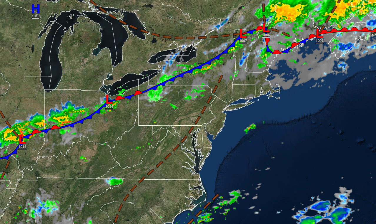
TOMORROW
A cold front will slowly approach the region with scattered showers and thunderstorms. Winds will be from the southwest at 5 to 15 mph. Temperatures will rise into the lower to mid-80s over the interior, mid to upper 80s along the coast, and upper 80s to lower 90s in the Delaware River Valley for highs.
TOMORROW NIGHT
The cold front will slowly press south with scattered showers and thunderstorms. Winds will be from the southwest at 5 to 10 mph. Temperatures will fall into the lower to mid-60s over the interior, upper 60s to lower 70s in the suburbs, and lower to mid-70s in urban areas for lows.
THURSDAY
The cold front will press through the region with showers and thunderstorms. Winds will veer from the southwest to the northwest at 5 to 15 mph. Temperatures will rise into the lower to mid-80s over the interior and mid to upper 80s along the coast for highs.
FRIDAY
High pressure will build into the region with clearing skies. Temperatures will range from the upper 50s to mid-60s over the interior and upper 60s to lower 70s along the coast for lows and mid to upper 70s over the interior and lower to mid-80s along the coast for highs.
SATURDAY AND SUNDAY
High pressure will produce clear skies to scattered clouds. Temperatures on Saturday will range from the lower to mid-50s over the interior and upper 50s to mid-60s along the coast for lows and mid to upper 70s over the interior and upper 70s to lower 80s along the coast for highs. Temperatures on Sunday will range from the mid to upper 50s over the interior and lower to mid-60s along the coast for lows and lower to mid-80s for highs.
MONDAY
A cold front will move through the region with isolated showers. Temperatures will range from the lower to mid-60s over the interior and mid to upper 60s along the coast for lows and upper 70s to lower 80s for highs.
TUESDAY
A stalled frontal boundary will produce scattered clouds and isolated showers. Temperatures will range from the mid to upper 60s over the interior and the upper 60s to lower 70s along the coast for lows and lower to mid-80s for highs.


