

An unsettled pattern will continue through the week, but the weekend looks to be dry and seasonable.
TODAY
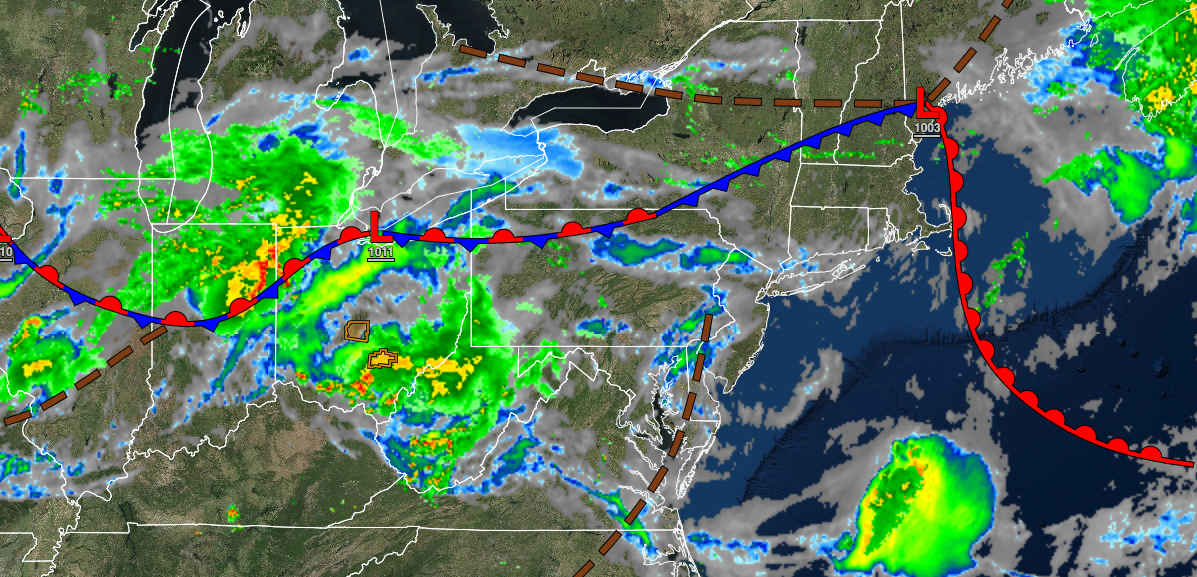
A cold front will clear the region by this afternoon with low clouds and fog giving way to scattered cloud cover by the afternoon. Winds will veer to the northwest at 5 to 15 mph. Temperatures will rise into the upper 70s to mid-80s over the interior, mid to upper 80s along the coast, and upper 80s to lower 90s in the Delaware River Valley for highs.
TONIGHT
High pressure will pass to the north with scattered cloud cover. Winds will veer from the northwest to the northeast at 5 to 15 mph. Temperatures will fall into the lower to mid-60s over the interior, upper 60s to lower 70s in the suburbs, and lower to mid-70s in urban areas for lows.
TOMORROW
A warm front will approach with increasing clouds and isolated showers in the afternoon and evening. Winds will be from the east at 5 to 15 mph. Temperatures will rise into the mid-70s to lower 80s along the coast and mid to upper 80s away from the coast for highs.
TOMORROW NIGHT
Cloudy skies with isolated showers are expected. Winds will be from the southeast at 5 to 15 mph. Temperatures will fall into the upper 60s to mid-70s for lows.
FRIDAY
A cold front will move through the region with widely scattered showers and thunderstorms. Winds will veer to the west at 5 to 15 mph. Temperatures will rise into the upper 70s to mid-80s over the interior, mid to upper 80s along the coast, and upper 80s to lower 90s in the Delaware River Valley for highs.
SATURDAY AND SUNDAY
High pressure will produce clear skies with scattered cloud cover. Temperatures on Saturday will range from the upper 50s to lower 60s over the interior and mid to upper 60s along the coast for lows and mid to upper 70s over the interior, upper 70s to lower 80s along the coast and lower to mid-80s in the Delaware River Valley for highs. Temperatures on Sunday will range from the mid to upper 50s over the interior and lower to mid-60s along the coast for lows and upper 70s to lower 80s for highs.
MONDAY AND TUESDAY
High pressure will move off the coast with scattered clouds. Temperatures on Monday will range from the lower to mid-50s over the interior and upper 50s to lower 60s along the coast for lows and upper 70s to lower 80s along the coast, upper 70s to lower 80s over the interior, and lower to mid-80s in the Delaware River Valley. Temperatures on Tuesday will range from the lower to mid-60s over the interior and mid to upper 60s along the coast for lows and upper 70s to mid-80s on the coast, mid to upper 80s over the interior, and upper 80s to lower 90s in the Delaware River Valley for highs.
WEDNESDAY
A cold front will approach the region with scattered clouds and isolated to widely scattered showers and thunderstorms. Temperatures will range from the mid to upper 60s over the interior and lower to mid-70s along the coast for lows and lower to mid-80s over the interior, mid to upper 80s along the coast, and upper 80s to lower 90s in the Delaware River Valley for highs.


