

A cold front will produce a stormy start to the week and another cold front is a threat for the Fourth of July weekend.
TODAY
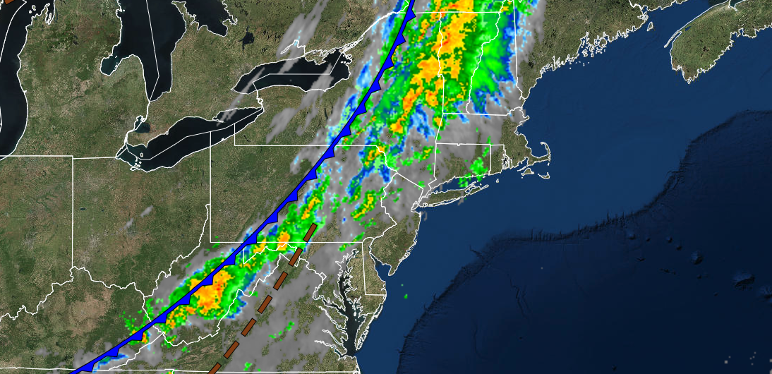
A cold front will move through the region with showers and thunderstorms a threat through the early evening. The thunderstorms will be capable of heavy downpours, frequent lightning, and wind gusts over 40 mph. There is a slight chance for a thunderstorm to reach severe levels with wind gusts over 65 mph. Winds will be from the southwest at 5 to 15 mph. Temperatures will rise into the upper 70s to lower 80s for highs.
TONIGHT
The cold front will exit the region with clearing skies from northwest to southeast. Winds will veer to the northwest at 5 to 15 mph. Temperatures will fall into the lower to mid-50s over the interior and upper 50s to lower 60s along the coast for lows.
TOMORROW
High pressure will produce clear skies with scattered cloud cover. Winds will be from the northwest at 5 to 15 mph. Temperatures will rise into the lower to mid-70s over the interior and mid to upper 70s along the coast for highs.
TOMORROW NIGHT
Scattered clouds are expected. Winds will be from the west at 5 to 10 mph. Temperatures will fall into the upper 50s to lower 60s over the interior and lower to mid-60s along the coast for lows.
WEDNESDAY
High pressure will produce clear skies with scattered cloud cover. Winds will be from the southwest at 5 to 10 mph. Temperatures will rise into the upper 70s to lower 80s over the interior, upper 70s to lower 80s along the coast, and lower to mid-80s in the Delaware River Valley for highs.
THURSDAY
High pressure will produce clear skies with scattered cloud cover. Temperatures will range from the upper 50s to lower 60s over the interior and lower to mid-60s along the coast for lows and lower to mid-80s along the coast, mid to upper 80s over the interior, and upper 80s to lower 90s in the Delaware River Valley for highs.
FOURTH OF JULY WEEKEND
FRIDAY
High pressure will shift off the coast with fog in the morning and scattered clouds in the afternoon. Temperatures will range from the mid to upper 60s for lows and upper 70s to mid-80s along the coast and mid-80s to lower 90s away from the coast for highs.
SATURDAY
A cold front will approach the region with fog in the morning giving way to scattered clouds in the afternoon. Showers and thunderstorms are expected in the evening and overnight hours. Temperatures will range from the lower to mid-70s for lows and lower to mid-80s along the coast, lower to mid-80s over the interior, and upper 80s to lower 90s in the Delaware River Valley for highs.
SUNDAY AND MONDAY (4th of July)
High pressure will produce clear skies to scattered clouds. Temperatures on Sunday will range from the upper 50s to lower 60s over the interior and mid to upper 60s along the coast for lows and upper 70s to lower 80s over the interior, upper 70s to lower 80s along the coast, and lower to mid-80s in the Delaware River Valley for highs. Temperatures on Monday will range from the mid to upper 50s over the interior and lower to mid-60s along the coast for lows and upper 70s to lower 80s over the interior and lower to mid-80s along the coast for highs.


