

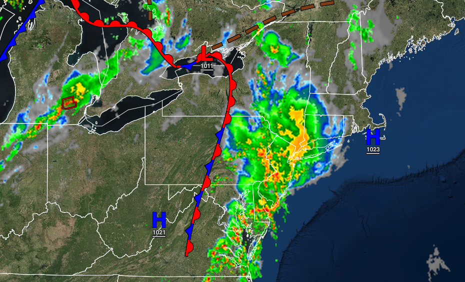
A series of frontal boundaries will keep the threat of showers and thunderstorms in the forecast for the end of this week and the next.
TODAY
The warm front will produce showers and thunderstorms in the morning followed by scattered clouds with isolated thunderstorms in the afternoon. The thunderstorms will be capable of heavy downpours, frequent lightning, hail, and wind gusts over 40 mph. Winds will veer from the southeast to the southwest at 5 to 15 mph. Temperatures will rise into the lower to mid-7os on Long Island, the upper 70s to lower 80s along the coast, and lower to mid-80s away from the coast for highs.
TONIGHT
A cold front will approach with showers and thunderstorms expected. The thunderstorms will be capable of heavy downpours, frequent lightning, hail, and wind gusts over 40 mph. Winds will be from the southwest at 5 to 15 mph. Temperatures will fall into the mid-60s to lower 70s for lows.
TOMORROW
A trough will follow with scattered clouds and a few isolated thunderstorms in the afternoon. The thunderstorms will be capable of heavy downpours, occasional lightning, and wind gusts up to 40 mph. Winds will be from the northwest at 5 to 15 mph. Temperatures will rise into the upper 70s to mid-80s over the interior, mid to upper 80s along the coast, and upper 80s to lower 90s in the Delaware River Valley for highs.
TOMORROW NIGHT
High pressure will build into the region with clearing skies. Winds will be from the northwest at 5 to 15 mph. Temperatures will fall into the lower to mid-50s over the interior and upper 50s to mid-60s along the coast for lows.
SATURDAY
High pressure will produce clear skies to scattered clouds. Winds will be from the northwest at 10 to 20 mph. Temperatures will rise into the upper 50s to lower 60s over the interior, mid to upper 60s along the coast, and mid-60s to lower 70s in the Delaware River Valley for highs.
SUNDAY
A weak trough will drop through the region with scattered clouds and a few isolated showers along the coast. Temperatures will range from the upper 40s to lower 50s over the interior and lower to mid-50s along the coast for lows and mid to upper 60s over the interior, upper 60s to lower 70s along the coast, and lower to mid-70s in the Delaware River Valley for highs.
MONDAY
High pressure will exit with increasing cloud cover. Temperatures will range from the upper 40s to lower 50s over the interior and lower to mid-50s along the coast for lows and lower to mid-70s over the interior and mid to upper 70s along the coast for highs.
TUESDAY THROUGH THURSDAY
A warm front will stall to the west of the region with scattered to broken cloud cover along with isolated to widely scattered showers. Temperatures will range from the mid to upper 50s over the interior and upper 50s to mid-60s along the coast for lows and mid-60s to lower 70s over the interior, mid-60s to lower 70s along the coast, and upper 60s to mid-70s in the Delaware River Valley for highs.


