


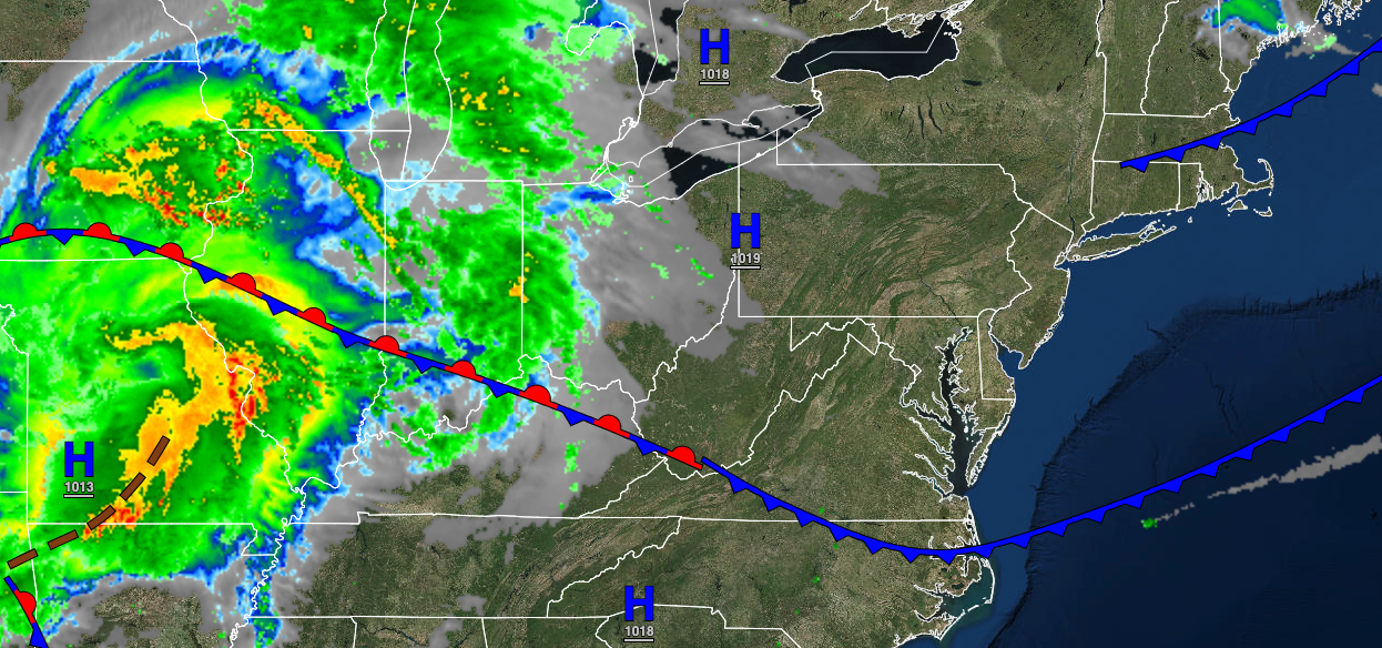
A warm front will bring rainfall to the region tomorrow and transport a hot and humid air mass to the region for this weekend. Another threat of thunderstorms returns on Sunday evening.
TODAY
High pressure will exit the region with increasing clouds throughout the day. Winds will veer from the northwest to the northeast at 5 to 10 mph. Temperatures will rise into the lower to mid-60s over the interior and upper 60s to lower 70s along the coast for highs.
TONIGHT
A warm front will approach from the south, with increasing clouds and showers developing towards midnight. The showers will be heavy at times. Winds will be from the southeast at 5 to 10 mph. Temperatures will fall into the lower to mid-50s for lows.
TOMORROW
A warm front will slowly lift through the region with showers in the morning followed by scattered cloud cover in the afternoon. The showers will be capable of heavy downpours at times. A few lingering showers will be possible in the afternoon and evening. Winds will be from the southeast at 5 to 15 mph. Temperatures will rise into the upper 60s to lower 70s over the interior, upper 60s to mid-70s along the coast, and mid to upper 70s in the Delaware River Valley for highs.
TOMORROW NIGHT
With the warm front well to the north, scattered clouds with areas of locally dense fog. Winds will be from the south at 5 to 10 mph. Temperatures will fall into the lower to mid-50s over the interior and mid to upper 50s along the coast for lows.
FRIDAY
The warm front will remain north of the region with fog in the morning and scattered clouds, and isolated thunderstorms in the afternoon. Winds will be from the south at 5 to 10 mph. Temperatures will rise into the lower to mid-70s on Long Island, upper 70s to lower 80s along the coast, lower to mid-80s over the interior, and mid to upper 80s in the Delaware River Valley for highs.
SATURDAY
A warm front will stall to the north of the region, with fog in the morning giving way to scattered clouds in the afternoon. Isolated thunderstorms are a threat in the afternoon. Temperatures will range from the upper 50s to mid-60s for lows and mid-70s to lower 80s along the coast and mid-80s to lower 90s away from the coast for highs.
SUNDAY
Areas of fog will be a threat in the morning hours. A cold front will produce showers and thunderstorms in the afternoon and evening. The thunderstorms will be capable of intense downpours, frequent lightning, hail, and wind gusts over 40 mph. Temperatures will range from the lower to mid-60s on the coast and mid to upper 60s elsewhere for lows and mid-70s to lower 80s on Long Island, lower to mid-80s along the coast, and mid-80s to lower 90s elsewhere for highs.
MONDAY
High pressure will produce scattered cloud cover. Temperatures will range from the lower to mid-40s over the interior and upper 40s to lower 50s along the coast for lows and mid to upper 50s over the interior and lower to mid-60s along the coast for highs.
TUESDAY
High pressure will exit the region with scattered cloud cover. Temperatures will range from the mid to upper 40s over the interior and lower to mid-50s along the coast for lows and lower to mid-60s over the interior, mid to upper 60s along the coast, and upper 60s to lower 70s in the Delaware River Valley for highs.
WEDNESDAY
A wave of low pressure will approach the region with increasing clouds and showers towards evening. Temperatures will range from the lower to mid-50s for lows and lower to mid-60s along the coast and mid to upper 60s away from the coast for highs.


